Posts Tagged With: Camprite

Pennyfather and Mapoon, West of the Tip

This slideshow requires JavaScript.

And so the long journey back south begins in earnest. The drive back from Usher didn’t seem too bad with only one termite infested tree blocking our way, then the corrugations to the Jardine River ferry didn’t shake the bones like they did on the way up. Maybe we have finally got used to bull dust and corrugations now? It seems normal to drive to the left of the road markings, along the less corrugated but clearly worn paths of the locals.

On recommendations from travellers we had met on the Cape we were keen to explore a little of the Gulf side of the Cape. After 4 weeks on the Cape we were in need of supplies, particularly fresh fruit and vegetables, and curiosity was leading us to the city of Weipa anyway, so restocking and refueling was the order of the day.
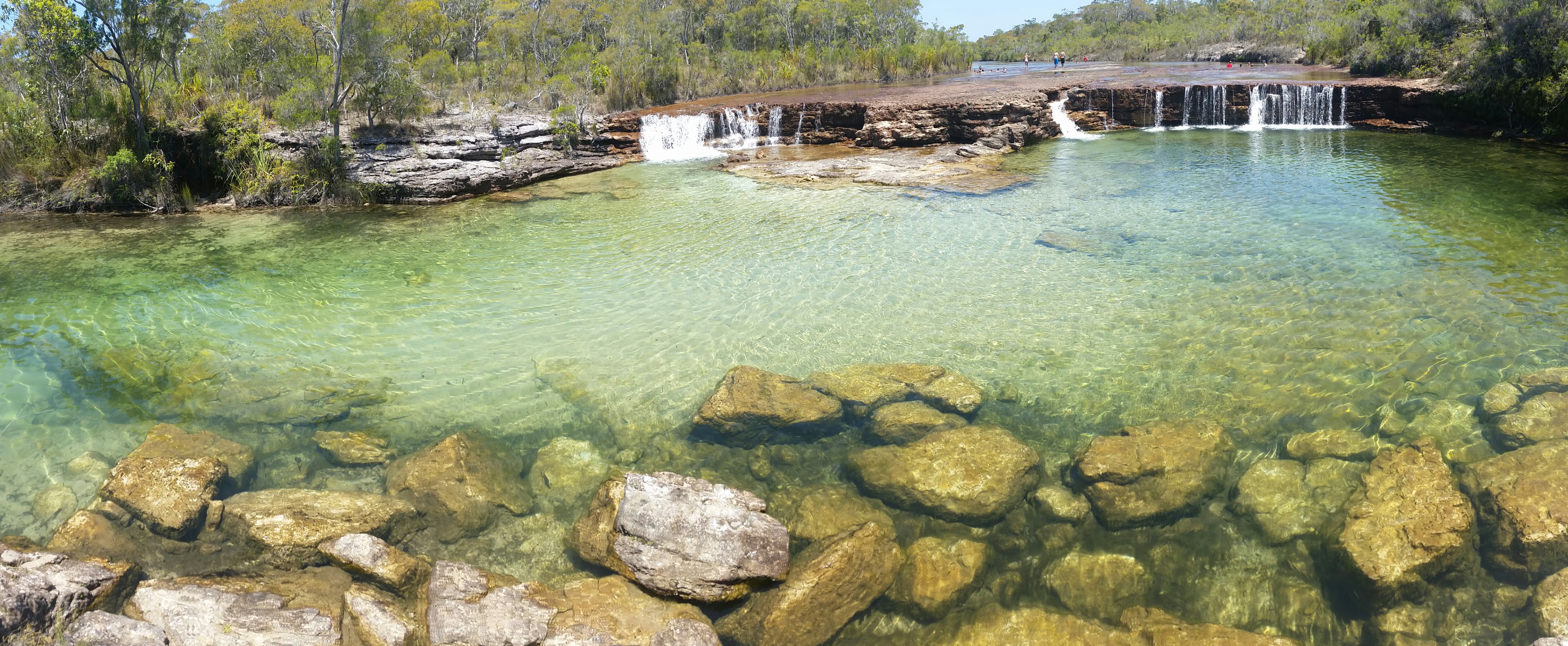
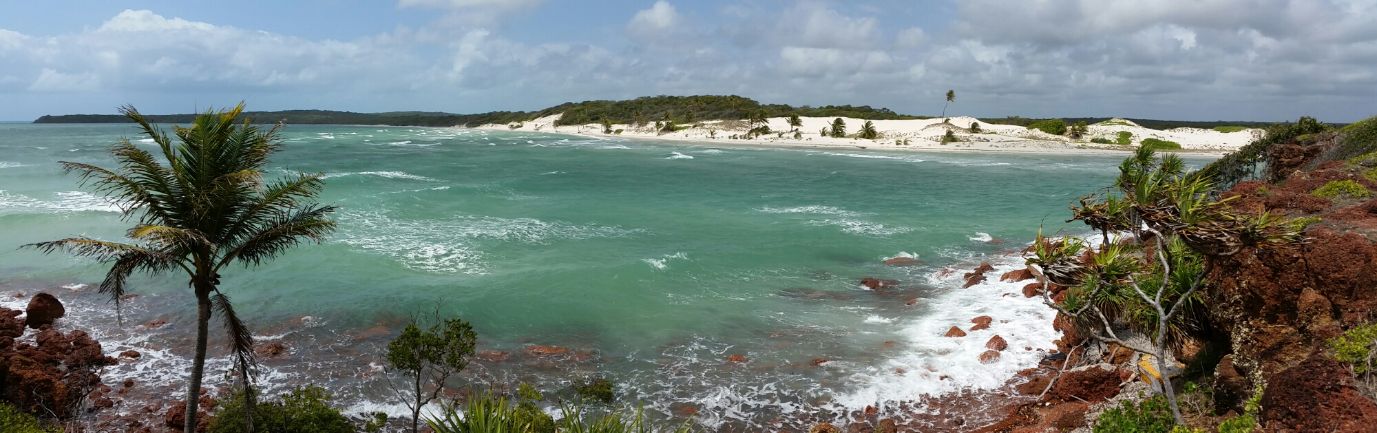
Fruit Bat Falls

Fruit Bat Falls

A quick stop was required, firstly at Fruit Bat Falls to wash away excess bulldust, then at Bramwell station to view the “Rego tree”. then on to Moreton station for the night.

A “short cut” from the Old Telegraph Track south of Moreton took us across Batavia Downs station to York where we joined the Peninsula Developmental road leading to Weipa. With the exception of a few heavily corrugated sections this road soon improved and before we knew it we hit bitumen driving into Weipa.

Just north of Weipa lies the Pennyfather River, supposedly a top fishing spot, but also a beautifully peaceful beach camp.

Access is via a Rio Tinto mining lease and the only traffic lights we have seen for a while were those for mine vehicles passing. The boom-gate was broken so we watched quite a few monster trucks pass by, with loads of dusty bauxite piled high in the hold. Even the water trucks managed to dwarf our cars waiting patiently for the gates to rise. They follow behind spraying hundreds of litres of water on the road to reduce dust levels. In the end Simon jumped out of his car and physically lifted the boom-gate so all could pass.

Being on Aboriginal land a permit is required but once there a very long beach offers many camping options, from basic amenities for a small fee, managed by a ranger to free camping along the beach, south of the local beach shacks. We chose the latter, searching for a site that another family had told us had the makings of a funpark made from washed up debris from the beach. After ten minutes driving along the soft sand it was time to stop and we found a great shaded spot with a tyre swing. The Gulf waters lapped gently on the beach and the glassy water was a welcome change from the wind blown east coast. Thirty minutes later an onshore wind blew up and brought a veritable swell with it, shattering the initial idyllic appeal of this west coast.

It did improve the next day and we had fun trying unsuccessfully to catch massive trevally that were cruising up and down the shoreline. The fishing gods were not kind to us and once again sausages hit barbeque instead of fresh fish.

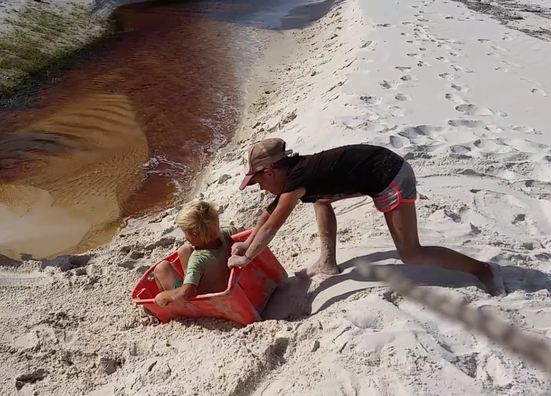
The kids built hammocks from fishing nets, strung between trees, and spent hours on the tyre swing.

Whilst we didn’t find a plaque, and there must be one there somewhere, the Pennfather River has historical significance as being the first place that a European landed in Australia. Willian Janszoon, a Dutch navigator, sailing in the Duyfken landed here in 1606, long before James Cook.

Today this area is totally alcohol-free and it is not permitted to even carry alcohol into this area, however, with no-one policing it, discarded bottles and cans litter the sand and bush where some people found it easier to discard rather than take the rubbish with them, thereby spoiling it for future visitors.

image

From Pennyfather we headed north for a couple of days to Mapoon where the Dulcie River meets the Gulf. The camp on the western ocean side offered more protection from the wind and on local advice Jackie Creek some 12km south along the beach offered good fishing opportunities

image

image

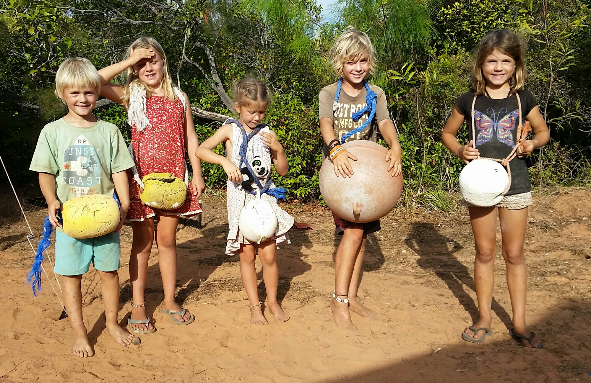
The kids together with Simon and Hilary’s girls scoured the shoreline for materials and commenced building a “humpy” city. Humpys are the temporary shelters that aborigines used, conical huts made from logs, with leaves or fur to cover the roof. The kids made scaled down versions from the long mangrove seeds that can be found everywhere, washed up with each tide.

Jackie Rivermouth

Jackie Rivermouth

Oscar and I slipped away for a quiet fish, driving down to Jackie Creek where we saw locals using spears to catch mud crabs amongst the reef. We had no success but witnessed plenty of “bait balls” of fish being doggedly pursued by larger fish around them and by a large flock of hungry terns diving wave after wave into the throng for a meal. The next day we returned at the right point of the tide and for a busy half hour caught mangrove jack for dinner, whilst keeping an eye out for a large crocodile we had seen when we arrived.

image

The wild horses called brumbies proliferate around Mapoon and Pennyfather too and it isn’t unusual, driving along the beach, to spot small groups or see their footprints coming to and from the beach and swamplands behind. We only saw the one crocodile and had a couple of shallow swims, then a local advised that they live in the swamplands behind the beach at this time of year, waiting for the big wet to arrive when they become more mobile and visible.

image

Shorebirds were present in abundance but with my ailing Canon EOS camera struggling to focus correctly, I couldn’t capture images

Categories: 4WD, Adventure, australia, Australian Outback, Beach, Big Lap, Camper Trailer, Discover Australia, Explore Australia, Journey Narrative, Kids Travel, Offroad, Photos, Queensland, Road trip, Travel, Travel Adventure | Tags: , , , , , , | 1 Comment

Usher Point, Cape York

This slideshow requires JavaScript.

With the Tip thoroughly explored we decided to take a 50+km track with Simon, Hilary and the girls to Usher Point. The road condition and distance is sufficient to deter all but the hardened traveller, and from the Hema guide the track was going to be tough. We had heard reports of 5-6 hours travelling time required with bush tracks so tight you would be relieved of paintwork along the way. Parks and wildlife don’t encourage trailers either but we were up for a challenge, the first, and by far the hardest, booking one of the four campsites. Once again we wrestled with a ridiculous booking system, being told only one site was available by a second operator.

The drive out was actually nothing like what we expected. It took two hours and the road must have been cleared in recent years judging by the size of the track and regrowth rates. No paint scratching on this track and very few challenges other than a couple of sections of soft sand. The Camprite trailer cruised through as it has done for the last 11 months without a hiccup.

Camp fun with beach flotsam

Camp fun with beach flotsam

Our campground greeted us piled with flotsam and jetsam salvaged from the beach, a blessing in disguise as whilst unsightly it did provide hours of entertainment for the kids. The coastline was rugged and exposed to the strong onshore winds. The four campsites are spaced across 2+km of track, one in the rainforest, one in deep soft sand behind the beach, another perched precipitously on a totally unsheltered overhung cliff (not good for sleepwalkers), and ours, nestled in low-lying bush, very slightly sheltered.

A lot of beach combing yielded more chambered nautilus shells, and a surprising source of multi-coloured clay that the kids insisted on bringing back to camp to play with. Much of the cliff was clay, however large islands protruded from the sand in places, with thin layers of many colours.

Go-karts made from beach rubbish

Go-karts made from beach rubbish

Gunshot Creek re-enactment

Gunshot Creek re-enactment

The kids used their imagination with items of rubbish found on the beach and from home-made go-karts made from fishing floats, raced down the track, to re-enactments of the Gunshot Creek crossing on the Old Telegraph Track, a lot of fun was had by all.

Turtle embryo in shell

Turtle embryo in shell

A broken turtle shell washed up one day with a dead embryo with features fully formed and clearly visible, including yolk.

The drive from the camp to the beach was the biggest challenge requiring lowering tyre pressures to handle the soft sand track and campsite. This sandy camp was separated by a murky but shallow creek, but fresh tracks indicated that it was inhabited by a small crocodile.

Sadd Point panorama

Sadd Point panorama

We stayed for three days, exploring the beaches, driving to Sadd Point nearby, and pushing an extremely scratchy track towards Escape Creek, where at times we were pushing over saplings higher than the car that were growing in there middle of the track.

The road to Sadd Point

The road to Sadd Point

I found a new favourite bird, the aptly named Magnificent Riflebird. Having heard its call I managed to coax one in close to see its beautiful metallic green collar, and hear its rustling feathers as it chased a female through the treetops. It eluded my attempts to photograph though.

This slideshow requires JavaScript.

Around the campfire on the first night we were interrupted by the erratic flight of a nightjar fluttering past several times. Following the frog-like sounds I found two sitting on the track every night. A Woompoo fruit dove allowed a close photo too one evening and once Simon’s very successful coconut lemon cake, cooked in the camp oven, wafted into the air we got regular visits from the local bandicoot.

Despite insistences from the booking consultant that campsites were full we saw no-one for three days at Usher Point. As we drove out a fallen tree across the road might have explained why, but four adults could move it aside quite easily, before we needed to reach for winches or saws.

Categories: 4WD, Adventure, australia, Australian Outback, Big Lap, Camper Trailer, Discover Australia, Explore Australia, Journey Narrative, Kids Travel, Natural World, Offroad, Photography, Queensland, Road trip, Travel, Travel Adventure, Wildlife | Tags: , , , , , , , , , | 2 Comments

The Old Telegraph Track, Cape York (Part 1)

With the Lenovo seeming dead I have adopted an Apple to continue blogging!

This slideshow requires JavaScript.

The Old Telegraph Track(OTT) is a very popular 4WD track that heads north up Cape York from Bramwell  Station to the Jardine river and beyond with the Telegraph terminating at Cable Beach near Punsand Bay, only 20km or so from the most northerly point of mainland Australia.

We left Morton Telegraph Station early, quickly drove 42km to Bramwell Station, keen but unsure what to expect at the first challenge Palm Creek.

A small wooden sign, not worthy of a photo pointed the track past the station and we pulled up at Palm Creek behind a big tour bus and a couple of other cars. Their eyes lit up and everyone reached for their cameras when we said we were going to cross.

It was certainly a bit more challenging than I was expecting but the word was if you can do this crossing you can complete the track. The entry into the creek was a two step, narrow muddy track with the tiniest bend towards the base. Total drop was possibly ten metres.

With other people arriving behind I jumped to it, handed cameras and video to people and started the GoPro running.

In the excitement of the moment I then made a number of rooky errors. Firstly, the GoPro was in camera mode so I got a photo of me looking at the camera – oops. Secondly, feeling the pressure of people waiting to cross I forgot to reduce my tyre pressures.

The descent was relatively easy as you just have to get your tyres in the tracks and keep them there while descending in low gear. The opposite side offered two exits and we chose the direct one. Naively thinking we could savour the moment with a slow ascent, I underestimated the traction on the slippery incline and sheepishly descended backwards after getting only the car nose to the top. On the next attempt I made my third error trying to ascend before the low range gear had engaged properly. The third time I beckoned to Amanda to grab the winch, put it round the nearest tree and 5 minutes later we were out. The tourist bus was happy with the spectacle but it was a very amateur effort indeed as the next cars showed us, roaring past in one attempt.

The ice was broken and we were on our way at last. Three kilometres later we arrived at Dulcie Creek, where track notes indicated care required to avoid deep holes. A muddy puddle sat in the middle of an otherwise dry river bed so this obstacle was passed with relative ease.

Dulhunty and Bertie rivers provided more water but these were more a case of avoiding deep holes in the rocky bed, nothing a quick wade in the crystal waters couldn’t solve.

One thing we did notice was that there are very few intact telegraph poles remaining. Souvenir hunters have bent the metal poles to remove the porcelain insulators along the entire track. There were some older wooden poles standing but these too lacked any porcelain adornments. They would look more impressive on the poles than sitting forlornly on people’s

The infamous challenge on the OTT is Gunshot Creek and we chose not to do this challenge as we were towing a fully laden Camprite trailer that we still needed to live in for some time. We bypassed this and setup camp at Cockatoo Creek, another crossing where deep holes in the riverbed need to be treated with respect. We camped above a deep waterhole and the kids spent the afternoon fishing and swimming. I spotted a big barramundi whilst spotlighting that night, and a quick well placed cast landed a 70cm fish for the next evening’s dinner.

Up early in the morning I took Oscar for a fish, still seeking his first barramundi, and landed a 72cm Sarotoga on my second cast. Unfortunately Oscar only caught some good-sized grunter. We also got a visit from the rare Palm Cockatoo which is a magnificent bird with a huge beak, black with red cheeks and a huge array of long feathers on his head.

So far the Camprite trailer was holding up very well and all was good. As the sun rose we prepared for as visit to Gunshot Creek.

Categories: 4WD, Adventure, australia, Australian Outback, Big Lap, Camper Trailer, Discover Australia, Explore Australia, Fishing, Journey Narrative, Kids Travel, Mitsubishi, Offroad, Photography, Photos, QLD, Queensland, Road trip, Travel, Travel Adventure | Tags: , , , , , , , , , | 1 Comment

Devils Marbles (Karlu Karlu)

It is a long drive from Mataranka to Alice Springs, with not much in between, and the major town, Tennant Creek, by all accounts is not worth staying in. We chose to ease ourselves into the cooler climate gently with two stops before Alice Springs. The first day we made a stop in Daly Waters to see the Stuart’s Tree, basically a tree stump with a large “S” engraved in the trunk (clearly visible if you squint both eyes and turn your neck at 45 degrees), supposedly engraved by John McDouall Stuart’s party on his third attempt to reach Darwin from the south in 1861/2. Then we had a quick look at the Daly Waters pub. Every inch of the walls and ceiling is adorned with caps, police badges, bras, foreign currency notes, rugby shorts, and much more. A cold beer would have been welcome but we still had more driving to do.

This slideshow requires JavaScript.

Very close to the town of Elliot, we stopped for the night at a magnificent birding spot known as Longreach billabong. This long waterhole allowed waterfront camping and as we sat there stately jabiru storks, spoonbills, and brolgas strutted along the water’s edge. Meanwhile, darters sunned themselves with wings outspread, and rainbow bee-eaters scanned the sky for their next meal while sitting on dead branches.

The sunset was one of the best we have seen on the trip and our fellow travellers from home, Joel and Abelia “Our Roaming Home” finally caught up with us to exchange stories around a campfire. A great finish to the day.

Up early the next day, after a chilly night, we set off for Kunjarra (The Pebbles) a sacred women’s site just north of Tennant Creek. The site itself offered little more than a chance to stretch our legs and stroll along a short path through a hillside of small rocks, so we didn’t stop long.

Just beyond Tennant Creek is another hillside covered in rocks, but Karlu Karlu, or the Devils Marbles are more impressive and worthy of a stopover. The campsite was very popular (full) but we squeezed in a spot and set off to explore before the sun went down. We all had a lot of fun exploring the rocks, climbing all over them, and Xavier read us the Dreaming stories of the Devil Man, Arrange who spat on the ground, where it turned into the granite boulders that now litter the surrounding landscape. Plenty of photo opportunities kept me busy, even early the next morning before we left.

Categories: Adventure, Animal Action, australia, Australian Outback, Big Lap, Camper Trailer, Discover Australia, Explore Australia, Journey Narrative, Kids Travel, Natural World, Photography, Photos, Road trip, Travel, Travel Adventure, Wildlife | Tags: , , , , , , , , , , , , | 1 Comment

East Arnhemland (Part 3 – Maccassan Beach)

From Giddy River we relocated to Maccassan Beach as a base to explore the surrounding area. One of our permits gave us access to the Dhimurru recreational areas to camp and this area includes a number of sites along the coast. Some 15km off the main, but unsealed road into Nhulunbuy, a signposted track leads you to a beach called Little Bondi. The track to the beach was tight and scratchy increasingly enclosed by bush on all sides as you approach, then soft white sand. I stopped short so we could check out the camp spot but despite the tranquil location it wasn’t deemed good enough for Fifty Toes Walkabout! Somewhat surprised by the decision we moved to turn around, but we had other beaches to check first. The only way out was to drive further onto the sand and we got bogged. With tyre pressures reduced even further and the recovery tracks in place we freed and after a nervous drive down the beach executed a hairy turn the soft sand, then back down to the hard stuff. Next stop Turtle Beach. This was a tiny beach with a couple of sheltered campsites. It looked great but no sun for our solar panels. The final spot was Maccassan beach, perfect for us with plenty of space, a few trees offering plenty of shade and plenty of open space and a bigger beach. The bauxite rock platform even promised fishing opportunities, but the onshore wind had built up and didn’t look like abating soon.

Nearby there was an interesting sacred site, unlike any other we had encountered to date. A fleet of up to 60 Maccassan trading boats from Sulawesi used to travel to this area on prevailing trade winds in December each year, for centuries up to 1907, to trade knives, tools and food for Trepang, or sea slugs. Each boat would carry up to 40 men and the 1,600km journey would take two weeks. The return leg would take place when the trade winds turned in April, often engaging local Yolngu people in the process.

The site consists of bauxite rock placements representing details of the trading interaction. Sections of the trading boats, called Praus line the ground in detail, others show the style of fireplaces required to boil the trepang, and fish traps.

Regulations imposed by a wary government in 1907 required these boats to register for tax in Darwin first, and trade winds couldn’t get them there so the trade ceased. The site consists of bauxite rock placements representing details of the trade. The rock placements are the only remnant of that ancient trade.

Bauxite is everywhere and for this reason Rio Tinto Alcan have a mine here. As a by-product of the mine’s presence in the Gove Peninsula Nhulunbuy is the sixth largest town in NT with a booming population of just under 4,000. Infrastructure is quite advanced for such a remote area and the hospital looked large for the town size.

The beach proved interesting, each day new tracks revealed nocturnal visits by crocodiles, turtles, and a few unknown creatures. Xavier and I walked to Turtle Beach past a billabong that was teeming with juvenile cane toads. You couldn’t help but tread on them with each step but too many to be able to do anything about them.

We took a drive to Rainbow Cliffs, then onto Goanna Lagoon. The road was comical because the original road runs direct into the bush but is crossed by tree trunk after trunk, brought down in recent cyclones, making the direct route impassable. Instead you have to zig zag your way constantly crossing the road at right angles to avoid the trees. Perseverance with the drive is rewarded with an opportunity to jump into crystal clear cooling waters (once you’ve checked for crocodiles of course) and the kids made the most of it.

We visited the exclusive art centre at Yirrkala where local artist’s work is showcased in an immaculate gallery. Whilst beyond our budget some of the artwork here was of particularly high quality, and the church panels in the museum gallery were a labour of love that took months to complete, depicting many of the cultural traditions. The Yolngu culture here is very strong and the people look so much more relaxed and comfortable, possibly because they have ownership of their own land and appear to be more in control of their destiny than in other areas we have seen. That said there are still many issues surrounding family, alcohol and drug abuse that one is constantly reminded of by posters around town, at the festival, and in local papers.

Then we explored the empty town beaches, starting at the refinery jetty where we watched dolphins and fished unsuccessfully again. Woodys beach was a hit, offering another safe swimming option in an enclosed but shallow area. A sandbar offered a walk to an island but with an incoming tide and a deep 4m wide channel to complete the crossing, we stopped. The next few beaches were deserted too and equally nice but we had a booking i.e. another permit to visit Cape Arnhem

Categories: 4WD, Adventure, australia, Australian Outback, Beach, Big Lap, Camper Trailer, Discover Australia, Explore Australia, Journey Narrative, Kids Travel, Natural World, Northern Territory, Offroad, Photos, Road trip, Travel, Travel Adventure | Tags: , , , , , , , , , | 1 Comment

Gibb River Road – Part 5 (Mitchell Plateau to Kalumburu)

On our return from the Mitchell Plateau we took a 20km detour to see Surveyors Pool. Again the road was slow and rocky but we were the only ones there and a short flat walk took us along a creek to the falls to Surveyors Pool below. Whilst looking very inviting we had been warned about saltwater crocodiles being present so just enjoyed the views. Pools above the falls were supposed to be safe but there wasn’t much water anywhere except in the creek down and I had already seen a crocodile in there. The return trip suggested they were freshwater ones but we weren’t that desperate for a swim.

Another crossing of the King Edward river, then a left turn onto Kalumburu road headed us north to Kalumburu itself. The road was quite acceptable for the next 80-100km, notwithstanding the occasional dip or floodway that causes you to brake sharply to avoid testing the suspension to its limits. On one stretch we were entertained by a pair of Brolgas performing a dance for us only ten metres from the roadside. So mesmerised by one another they didn’t seem to notice the car and trailer screech to a halt, the massive cloud of dust that followed, nor me jumping out of the car clutching a camera and proceeding to enter the grass near the performance. Finally they did notice and very calmly beat a slow retreat into the grassland where we left them in peace.
Then we had our first major casualty as the trailer drifted on a corner hitting a rock and giving us our first flat. As I was remembering how to change the trailer spare (squirrelled cleverly under the trailer) a posse of young guys on a fishing trip, in 5 cars, pulled over and proceeded to take over. What probably would have taken me an hour was completed in fifteen minutes and we were all on our way again. Thanks guys, we hope you caught lots of fish up there for the good karma.

Most of Kalumburu was closed as we arrived late on a Sunday afternoon so we didn’t have a chance to stop and explore but a couple of lads showed us the way to Honeymoon Bay. We got there to find Crystal and Marty had arrived shortly prior and Hannah quickly resumed her dog-minding duties with their dog Zoe.
And with the next rising of the sun the mighty Marty punt was launched skippered by Captain Marty and his crew were Oscar and I clutching our tackle box, rods and bait bucket. Early signs were not favourable with no action but as our intrepid skipper “sailed” further towards the point things heated up. Oscar was catching batfish the size of dinner plates and Marty was straight into a sweetlips. We could see fish all around following our lures and bait in, so it was time to bring out the “desert island jig”, so named because if you were only allowed one lure to take to a desert island this white feathery one would be the one. I had bought this after seeing what people caught with it in Broome.
Bingo! Almost first cast I caught my first Queenfish and quite a respectable eating size too. Crumbed fish pieces that night were divine.
Day 2 on the mighty Marty punt yielded similar results though we did have a couple of break-offs and we saw a couple of large spanish mackerel cruising around too, though couldn’t hook them. Happy fishermen all round as we had at last started to catch some decent sized fish.
We could have stayed longer and missed a few things but finally we had to leave Honeymoon Bay and head south again, leaving the big boab tree, with eagle nest in its branches, overlooking the bay.

Categories: australia, Australian Outback, Camper Trailer, Discover Australia, Explore Australia, Fishing, Journey Narrative, Kids Travel, Offroad, West Australia | Tags: , , , , | Leave a comment

Ningaloo Station

Ningaloo Station is a homestead to the south of Cape Range. Historically, four-wheel drive enthusiasts have used the crossing at Yardie Creek to make the trip from Coral Bay to Cape Range considerably shorter than having to go via Exmouth. Unfortunately for us the recent cyclones meant Yardie Creek was several metres deep and there had been a recent incident where someone had tried to cross the sandbar and ended up with his car written off. It was stuck for two days before it was retrieved. We took the main road, taking a brief diversion into the eastern side of Cape Range to visit the Charles Knife gorges, the main one, ShotHole Canyon was still closed from the recent cyclone. As well as commanding fabulous views across the peninsula, there are a number of well sites throughout the North West Cape where oil exploration had taken place in the mid 1950s. After drilling almost 4700m and not finding commercial hydrocarbons the wells were plugged.


On recommendations from WA locals, Brett and Doreen, and Gary and Pam, we had set our minds on visiting South LeFroy campsite on Ningaloo. The road in to the homestead was very corrugated and after an hour we arrived at a very dilapidated looking house surrounded by a huge flock of sheep and a handful of goats. Most of the coastal stations are for pastoral grazing and their 99 year leases will expire in June. The government is trying to reclaim the 2km coastal strip seeing potential to protect and/or develop the resource and regulars are concerned that their paradise will be lost forever, or will become too expensive. Currently dog-friendly, but lacking toilet and rubbish facilities, chemical toilets are required and rubbish needs to be taken with you when you leave.

A National Park style development would be ideal, however, the prospect of developing expensive eco-resorts would surely not bode well for the pristine coral reefs that lie metres from the beach in the crystal clear waters. We’ll watch this closely to see what happens.

A week at Ningaloo was not enough. We spent hours beachcombing or swimming over the reef. Reef sharks, turtles, abundant corals, and fish life proliferate. A short drive from the campsite took us over the sandhills, past the water bores to Norwegian Bay, the derelict site of an old whaling station. The rusting hulks of boilers and machinery littered the land behind the beach and made for some interesting exploration. The remnants of the old jetty and more machinery sit peacefully on the beach, now a marine reserve, and a solitary dolphin was hunting in the shallows 50m further along the beach.

A short diversion off the same road takes you to a popular fishing spot called Shark Alley. We visited several times, and couldn’t resist a snorkel. This was probably the clearest water but a strong current meant the kids had to be careful not to stray too far from the shore. Surprisingly though no sharks were spotted but more turtles and plenty of fish. Oscar’s new favourite fish was the giant unicornfish that really does have a unicorn protruding from the top of its head. We fished there and caught some of the most beautiful coloured wrasse and trigger fish. Nothing for dinner that day though.

On our last day Oscar and I were taken out fishing in the lagoon. One monster nearly pulled Oscar off the boat as he tried to reel it in, with me holding onto him, before it shook the hook. On the last cast of the day, with the sun having just set, I managed to land a legal sized spangled emperor, so no sausages for dinner!


Categories: Adventure, australia, Australian Outback, Beach, Big Lap, Camper Trailer, Discover Australia, Explore Australia, Journey Narrative, Kids Travel, National Park, Natural World, Offroad, Photography, Photos, Travel, Travel Adventure, West Australia | Tags: , , , , , | 2 Comments

Cyclone Quang – Exmouth

Our new friends, Helen and Matt the “Drought Breakers”, as they had quietly confessed, decided they would head out the next day seeking refuge inland. We suggested that they might seek government funding to tour some of the inland farming regions that are in dire need of rainfall. Another family, from Perth, the “Grismacs” that we had shared dinner with also decided it was a better option to get out and seek drier conditions, despite having paid for five nights. The next morning the campsite evacuated leaving us with only a couple of other neighbours prepared to wait and see, monitoring the conditions. This was pretty hard without any mobile phone reception, so we were relying very much on updates from our camp hosts.

Later that day “Roving Reeves” arrived, having pre-booked five nights at Osprey Bay. We had met Natasha and Steve at Francois Peron national park and the kids had got on really well. We had evening drinks in their luxurious caravan, after a late afternoon snorkel in perfectly calm conditions.

We could see rain and lots of weather to the west and east, but it looked like we were going to dodge it. Before going to bed it was supposed to be heading south crossing the coast at Coral Bay.

The rain started at 2am, with the wind strength gradually rising constantly shortly after. By 5am I was up in the driving rain hammering pegs in harder to keep the awning up. Ironically, I had bent three pegs driving them in as the ground was so hard when we had arrived but now, with a bit of rain, the ground softened very quickly.

At 5.30am Dennis the camp host was driving around in the dark telling us all to get out at daybreak as Cyclone Quang had changed direction and was now going to touch down at Cape Range and Exmouth.

De-camping was ridiculous! Driving horizontal rain soaked everything, and packing down the awning was like wrestling with an angry dragon as canvas flapped and whipped in all directions. Steve “Roving Reeves” very kindly emerged to help us complete the task, stating that they would probably sit it out, but by the time we left, 30 minutes later they had been told they had to go.

We headed out of Cape Range, hoping the roads hadn’t flooded yet, towards Exmouth, hoping to find refuge there. The wind and rain got worse and worse, and we slowed down to 60km/h. In Exmouth we had a unit booked to spend a week with the in-laws and we were lucky to get early access. Like drowned rats we all poured out of the car and into our new luxury home.

It got worse and worse, the unit started leaking then all power went. We waited and watched through the windows, then suddenly by early afternoon I heard corellas squawking and flying around. Thinking it might be the eye of the storm we stayed put but by 4pm we had glorious sunshine again, enough to open up the trailer to start the drying out.

Without power in the unit we had to transfer all our new shopping into our super reliant and trustworthy Eva Cool fridge-freezer in the Camprite. Some eight hours later it resumed, though half the town still had no power the next day.

Luckily the cyclone was diffused quickly by another weather system that collided with it, resulting in it passing with minimal damage. An interesting experience indeed for Fifty Toes.


Categories: Adventure, australia, Australian Outback, Big Lap, Discover Australia, Explore Australia, Journey Narrative, Travel, Travel Adventure, West Australia | Tags: , , , , , , | 3 Comments

Exemplary Customer Service in Perth

We had to head to Perth to get the Pajero and Camprite trailer serviced before we commence the journey north and possibly the most eagerly awaited part of our trip. Both have performed excellently to date but I had a list of items to follow up with for both.

I wanted to ask further questions about the problems with had with fuel consumption in South Australia and had been tipped off about possible carbonisation of an inlet manifold. We had also recently become aware of a recall notice on the model. I finally wanted to resolve the issue with our towbar being too low, and Mitsubishi Melville instantly gave me confidence with their understanding of each issue and ability to address them. We also needed to perform a tyre rotation having just clocked another 10,000km.

The Camprite trailer went in first and it was great to meet the team in person, as we had only had spoken by phone from the east coast. Matt patiently listened to my list, had a quick look at the trailer and spotted a couple of things we had missed, again assuring that they were all fixable. We left it in his capable hands and I took the boys to SciTech in the city.

The next day was the Pajero’s turn. They kindly agreed  to complete the service by 2pm (so I had time to pickup the trailer on the other side of the city) and went through my list of items. They couldn’t put in a second battery, but I was less concerned about that. Phillip from Mitsubishi drove me back to the house, where we were staying and also picked me up promptly at 2pm. Everything was fixed up and the spare tyre lift meant we were set to fix our towbar issues.

Being the afternoon before Easter holidays, traffic crossing town was heavy and Matt at Camprite was patiently awaiting our arrival to pick up the trailer. It looked like new! Our damaged rear steps had been replaced with the new design and all the other items on the list had been addressed, leaving us a little time to fix the towbar. Matt optimistically thought it would be a quick reversal of the towbar, but that proved more difficult requiring some heavy duty hardware and hammering for quite a while to remove. Reversing it didn’t solve the issue as the tongue was not long enough so Matt quickly drove up to get one. He returned empty-handed and we jumped into the car at 4.40pm to try a different place. Success!

The tongue then needed machining the edges of the tongue to allow it to be inserted easily – more time passed.

Finally by 5pm the job was complete, Matt was still smiling, but we were so grateful that he had stayed back to help prepare us for the next stage of our journey.

Thank you very much Camprite – your attention to detail was probably the best we have ever encountered and thanks also to Melville Mitsubishi for your prompt, friendly and efficient service.

Categories: 4WD, australia, Big Lap, Camper Trailer, Car, Discover Australia, Explore Australia, Journey Narrative, Kids Travel, Mitsubishi, West Australia | Tags: , , , , | 5 Comments

Into the Nullarbor

As we drove towards the Nullarbor Plain we couldn’t resist to stop for the road signs, look out for Camels, Kangaroos and Wombats. Pulling over at lunchtime the kids soon were running back to car clutching beautiful feathers, asking what they were from. A quick scan of nearby trees revealed a group of Major Mitchells, or Pink Cockatoos, beautiful birds and one to add to the list of sightings.


At Nullarbor we turned north off the road, to look for Murrawijinie Caves, lying approximately 10km along a dirt track. The temperature gauge snuck up to 46 degrees and was testing everyone. Why were we looking around in this heat in the bush for caves didn’t need to be said but the moment they set foot in the cool shaded environment below all was forgiven. I have never seen Amanda move so fast down a 3m log to get out of the heat. We found a wall with aboriginal red ochre hand paintings which proved quite exciting for the kids. In one cave we climbed down some tight passages until we found a large pile of bones, those of animals who had entered and perished after failing to find their way out. Many raptors roost and nest in the cool caves and so we found many rodent bones scattered in piles too, particularly beneath one owl nest.

After killing some time out of the heat we finally had to re-emerge from the caves and find a camp. We camped at the head of the Great Australian Bight, literally on the clifftops, not a place to go if you are at all susceptible to sleepwalking.

Up early and off again before the wind could blow us over the cliffs! We found a zebra crossing in the middle of the Nullarbor Plain (only a few hundred cars cross the 1600km plain daily) so we had to use it. After a couple more lookouts we decided to explore and drove off along an unsigned little track.

After 15km a myriad of diminishing tracks brought us to a homestead and a vintage car graveyard. We were looking for more caves but gave up eventually fearing our ability to retrace our route back along the tracks. But first we had to take photos and a GPS position to check where we had been later.

This slideshow requires JavaScript.

Finally we worked our way back to the main road and headed West again. Next stop West Australia!


Categories: 4WD, Adventure, australia, Australian Outback, Big Lap, Camper Trailer, Discover Australia, Explore Australia, Journey Narrative, Kids Travel, Photography, South Australia, Travel, Travel Adventure | Tags: , , , , , , | 3 Comments

Blog at WordPress.com.

%d bloggers like this: