
Mangrove Jack for dinner

Step 1 – dig some dirt

Dad’s even bigger barra

Exiting Nolans Brook

When whiskers meet

Sieving for garnets

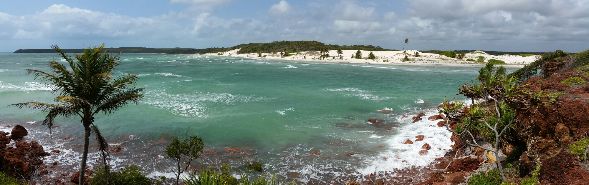
The western most point of Australia, Steep Point

Salmon at Dunn rocks

Windmills par 4

Dinner

Fresh Oysters
OK so this is a bit out of order but number 4 will follow next week when I get the youngest to provide input
What were your three favourite places and why?”
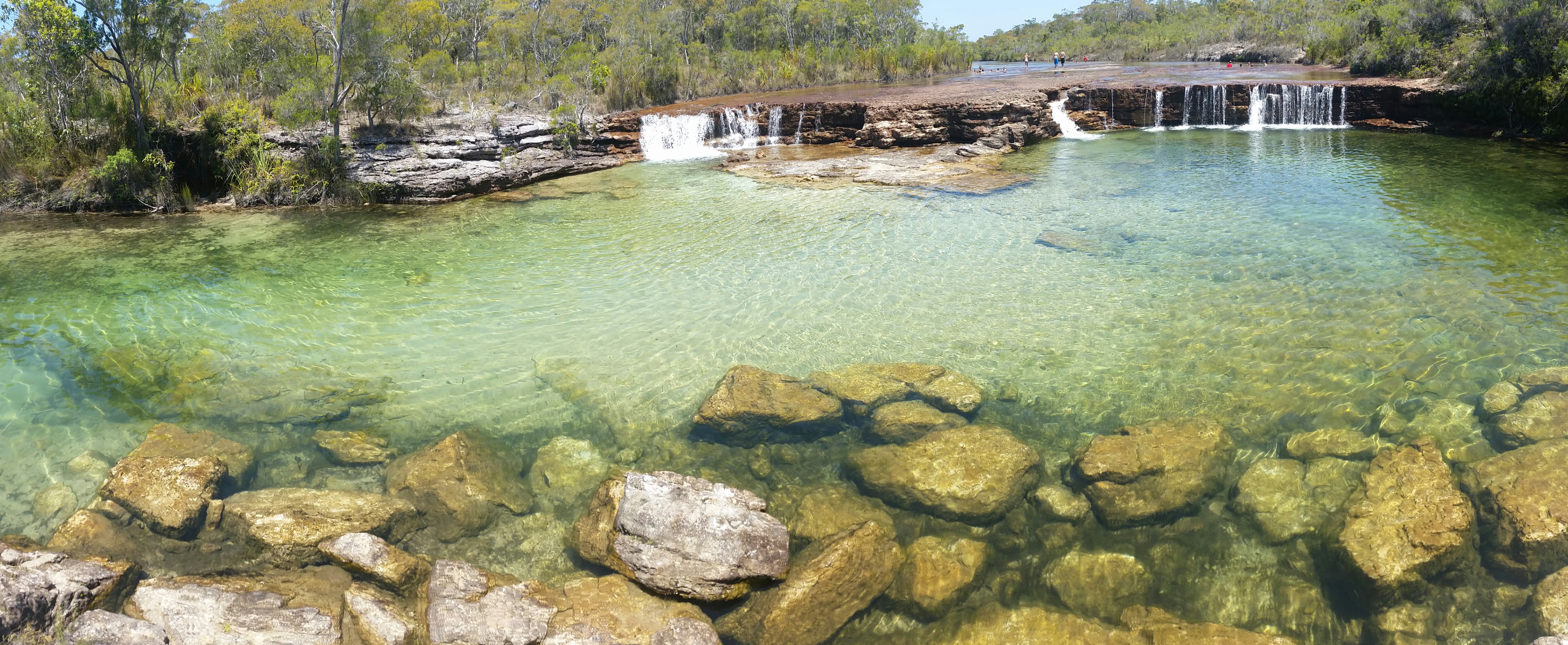
- “Cape York has to be on the list. Six weeks on the Cape was enough to have a good look around but we still didn’t see everything. The rugged tracks, and river crossings especially along the Old Telegraph Track were a fun challenge. The National Parks were beautiful and uncrowded and full of beautiful wildlife, especially the birds. For me the fishing here was highlight of the whole trip, partly because it was where the barramundi finally started getting caught but there were plenty of fish even in the dry season. The variety of habitat throughout the Cape continued right until the very tip at Pajinka. Beautiful beaches and a place where you can escape the crowds without too much difficulty”
- “Arnhemland impressed me from several angles. Firstly the sheer rugged and raw natural feel to it. On both our sorties into the region it was heartening to see rich aboriginal culture still thriving here and whilst we only had limited contact with people from the communities, those brief encounters were rich and very positive experiences. Watching my daughter being led to dance the Emu dance on the main arena by a local indigenous girl at the Garma festival was gorgeous. Even better was the fact that she was the first up and participated with quite a few dances. The camping was controlled by a permit system that works well despite the paperwork required to obtain permits.”
- “The Kimberley region in WA again provided a huge diversity of experience. Challenging driving on extremely corrugated dirt roads, particularly north of the Gibb River road, cultural glimpses into the past through some magnificent rock art sites, and uniquely refreshing waterfalls and gorges scattered through the region. The flora and fauna too is very different, the boab trees being the most obvious residents with their massively bloated trunks and relatively short spindly, outstretched branches. This was where we first encountered crocodiles in numbers, both fresh and saltwater ones.”
- Tasmania and Cape Levique would be very close behind these, places where we didn’t spend long enough and could easily revisit
“What was the best thing you took on the trip?”
“Probably my camera to allow me to capture glimpses that will forever remind us of the trip. Things like the air compressor and recovery tracks were essentials that we couldn’t have done without, given some of the places we visited. It was really important to make sure we could cope with any scenario as we were often travelling on our own”
“What did you miss most, or just couldn’t take with you?”
“I missed my Scuba gear the most. Given we spent a large part of the trip close to the ocean it was hard to go past places and not be able to dive. Unfortunately with the amount of gear I take diving it would have meant leaving all of the kids behind! A kayak or canoe would have served us well especially in the croc free areas. We had racks for them but just shied away from buying them. Perhaps next time I will do a lap dedicated to fishing and diving.
We didn’t physically have space to take a chainsaw, and in the end I left our axe behind to reduce weight. We coped fine without even with trees across roads – there are always other options available to you.”
“Would you do it again?”
“Yes. Probably in a different approach. I’d like to spend 1-2 months in a specific area to dig deeper and explore areas in more detail. Being on a strict budget we couldn’t do everything we wanted this time and a shorter trip would be easier to budget and plan for. Our trip was what I have christened “the reconnaissance trip” getting an idea of what is out there. With so much to see we’d have to spend years to see it all”
“How did schooling on the road go?”
“We used Sydney Distance Education Primary School. We chose not to use iPads as a large proportion of the time we had no, or limited, access to wifi or even telephone coverage. Packages of work were sent to our choice of destination (usually a post office) regularly then we would post back every fortnight. Teachers were always available for chats with the kids for those rare occasions we did have coverage. A daily routine was not possible due to the ad-hoc nature of our travelling, with days of cramming often engaged when a suitable location was found. That said we did focus on teaching times tables whilst driving along. The main challenge was keeping the kids motivated to complete assignments, particularly when other kids could be seen running around a camp, or there was a new place to explore”


Recent Comments