QLD

Queensland

A hidden oasis – Lawn Hill Gorge

In the north western corner of Queensland, a short distance south of the Gulf of Carpentaria, and close to the border with Northern Territory, lies a gorgeous oasis known as Lawn Hill gorge, located in the Boodjamulla National Park. The waters are safe to swim in, teeming with fish and birds aggregate around the water source in abundance. Indarri falls are a short bush walk away, and a beautiful place to cool off in the midday heat. The more adventurous can swim back to camp, or float back as we did on noodles and inner tubes.

Nearby in the surrounding dry savanna bush you can find one of the richest mammal fossil deposits in the world, at Riversleigh.

It is remote and a long trek in, but worth staying a few days to take in some of the walks, enjoy a swim, hire a kayak, or just relax and enjoy the views

It closes for the wet season around early November.

Categories: 4WD, Adventure, Australian Outback, Big Lap, Discover Australia, Explore, Explore Australia, Journey Narrative, National Park, Offroad, QLD, Queensland, Travel, Travel Adventure | Tags: , | 2 Comments

Return to Noosa

Almost a year after we last left Noosa with heavy hearts the promise of a joyous family occasion saw us departing Sydney in the early hours and heading north for my cousin’s wedding. The plan was simple – drive the 1,060km up the coast in the first day, the kids sleeping for a good 4 hours before dawn, a few stops to stretch legs, swap drivers, grab a quick snack, five nights in three locations then return more sedately via the inland road, taking two days, and allowing time to fossick for sapphires in gem country.

Our first stop was the relative luxury of the Noosa Islander resort and catching up with cousins and their families, who are usually scattered around the globe. The kids took over the pools and spas and we made the obligatory walk out to Hells Gate in the National Park. Only minutes from the main street in Noosa the National Park always presents fantastic opportunities to see Australian wildlife at it’s best. Our British visitors were not disappointed witnessing dolphins swimming close to the shore, dozens of turtles, and even a pod of 4 humpback whales less than 100 metres from the shore. We indulged in the pleasant waters of one of the beaches then looked for Koalas in the Eucalypt forest of Tea Tree Bay.

A short ferry took us across the Noosa river to the North Shore where we enjoyed two days escaping the very popular triathlon and celebrating my cousins wedding. Lots of dancing and merriment – the chocolate fountain was a favourite with the kids and the day passed all too quickly.

We found a baby frogmouth on the ground and a call to Australia Zoo was made. A pick-up was suggested but we didn’t witness it.

Then as the week came to a close an invite to stay on a houseboat for a night changed our plans and we extended our stay a little longer. We fished, swam in the river, caught up with family for a little bit longer, and looked out for Richard Branson on his island in the river, Makepeace island. He wasn’t there!

A peaceful night on the boat, then home the next day – the extra night meant a long drive back in one day and no fossicking this time.


Categories: Discover Australia, Explore Australia, Fishing, Journey Narrative, Kids Travel, Location, QLD, Queensland, Road trip, Travel | Tags: , , | 2 Comments

Fraser Island (Part 2)

The following day saw us heading north to Sandy Cape, up past Indian Head, Waddy Point, through the cute settlement of Orchid Beach, before heading up the beach again. With the tide being quite high on the way up we had to briefly leave the beach at Ngkala Rocks taking a bypass track that squeezed us through the rocks. We spotted two more dingos on this trip and at Sandy Cape the road to the lighthouse was impassable due to the tide, so we took to foot to walk over the dunes to the Carree campsite. The tall sand dunes plummet to the seashore and the kids ran up and down in the hot sunshine whilst we watched. The lighthouse poked out from the trees several kilometers to the west of us but too far to walk in the heat.

On the return trip we visited the Champagne Pools, somewhat disappointing due to the fact that each pool had fifty backpackers wallowing in it, some of them stripping off and crushing snails to feed the fish, despite the “no collecting” signs.

When challenged one said he was with an Aboriginal who said it was ok to do so. Whilst indigenous people do have privileges to collect within National Parks, tourists don’t and when others started copying the marine life will soon be stripped and spoilt for the future. I found it surprising that the indigenous guide had allowed this, as most aboriginal people we have met consider themselves to be guardians of the land they occupy. In this case perhaps the lure of the dollar was more important than preservation of the environment.

We walked to the tips of Waddy Point and Indian head to look for sharks, turtles and more but returned disappointed.

On the return trip we headed east at Orchid Beach to visit Wathumba, a large estuarine area, with a wooded coastline and mangroves growing in the sand. This beautiful spot is notorious for sandflies but we didn’t witness many at all.

Another day, another excursion and we headed south to take in the Central Lakes drive. Out timing of the tide wasn’t good and when we arrived at Eli creek some thirty cars on both sides of the creek were awaiting the tide to abate. Some of the Tag-Along tours had fixed itineraries though and were not prepared to wait. The 4WD vehicles driven primarily by inexperienced backpackers nervously entered the water, sometimes to their leaders horror even taking a precarious passage over rocks. Whilst the water wasn’t too deep I was prepared to wait a bit longer rather than taking a brine rinse under the bonnet.

One vehicle stalled on the exit and couldn’t be restarted by the driver. Without a snorkel it looked like this could be the end of their day but the leader emerged from the back of his vehicle with a can of CYC spray and with a prolonged spray under the bonnet life was restored in the engine and off they drove.

As we crossed shortly after four guys were digging sand out from the wheels of a very bogged car near the front of the queue.

Once across the creek and past Yidney and Poyungan rocks along the beach the track heads inland and a short drive through the forest brings you to the Lake Wabby Lookout. The lake is easily accessible from here and despite the threats of a dark storm approaching we couldn’t resist. The water was surprising warm for the deepest lake on the island and with steep dunes plunging into the deep water it was a favourite with the kids.

Beyond that is another major attraction, Lake Mackenzie, whose brilliant white sandy shores and pale blue acidic water grace all the tourist brochures. To avoid crowds, a short walk along the beach, and over a few steps, brings you to a second beach. Still no sun but plenty of crystal clear warm water to swim in – irresistible. The drive continued past Lakes Birrabeen, Benaroon and Boomanjin, all picturesque and much less frequented by the crowds of tourists but time was flying and we had to drive back up the beach.

As the rusting wreckage of the Maheno emerged from the sea spray in the distance we knew were almost back at camp again where the kids needed to be woken up, having fallen asleep in the car, after another exhausting day on Fraser Island

Rusting hulk of the Maheno

Rusting hulk of the Maheno

Categories: 4WD, Adventure, australia, Australian Outback, Beach, Big Lap, Discover Australia, Explore Australia, Journey Narrative, Kids Travel, National Park, Natural World, Offroad, Photography, Photos, QLD, Queensland, Road trip, Travel, Travel Adventure, Wildlife | Tags: , , , , , , | Leave a comment

Fraser Island (Part 1)

After over a week’s unscheduled stay in Noosa it was time to revisit our last major 4WD challenge of our trip, Fraser Island.

Having visited twice previously the plan this time was to explore beyond the typical tourist attractions. Previous trips had been restricted to 3 days and had seen us staying on the south east side of the island exploring only half of one side of the island.

Personal ferry service to Hook Point

Personal ferry service to Hook Point

The ferry terminal at Inskip Point is a beach of soft sand 100m from the unsealed road. As we drove onto the beach the ferry had just departed, but as I accelerated across the beach the skipper must have seen us, reversed and returned to pick us up. The ferry was empty so we got our own personal ferry service which made it seem worthwhile considering the rather pricey cost for a 5 minute crossing. The deckhand joked that he would save us a place on our return trip in a week’s time.

We had timed the tides well and drove from Hook Point along the beach and up the eastern beach, some 65km to Yurru campsite, just north of Cathedral Beach camp. The beach is under normal road regulations with a speed limit of 80km but following recent rain the unwary can be caught out at this speed with washouts.

Despite being the largest sand island in the world, over 100km long and 20km wide, there is no shortage of static and flowing freshwater and the erosion of beach sand caused by creeks can cripple the suspension of even the most sturdy cars if hit too fast.

Driving up the beach we were treated to the sight of two inquisitive dingos, then as we approached the Eurong settlement six dingos including young pups were running around the vehicles of some fishermen. Nothing beats the traditional dingo welcome to Fraser island. A ban on dogs on the island has retained the pure-bred status for these dingos as inter-breeding often occurs back on the mainland.

Shortly before Yurru camp the majestic wreck of the Maheno emerged through the sea spray in the distance.

The Maheno sank in 1935, washed ashore in a cyclone, but sufficient remains make it an interesting stopping point for tourists. Original wooden decking still lines some of the wreck, even after exposure to daily tides and the occasional cyclone storms over the last eighty years.

On our first day a transmission warning light came on and when actions recommended by the car manual failed to rectify it we were in a bit of a quandary. It still drove so we chose to ignore it until we got off the island again!

With a very changeable and wet long range weather forecast we chose to explore as much as we could in the first two reasonable days.

The northern forests scenic drive took us initially to a lookout over Knifeblade sandblow where the tops of overrun treetops poked starkly out of the sand. Lake Allom, further inland offered a warm refreshing swim amongst the freshwater turtles. We then took a couple of tracks to explore the western coast, Awinya and Woralie creeks. With a prevailing easterly wind, it was nice to experience calm beaches with no surf on the western side of the island. The camp at Woralie was very attractive though the creek crossing was very deep and not one that we were prepared to attempt. We were half way across when I decided it needed to be waded and when the water reached my chest I was glad I hadn’t proceeded.

Woralie Creek beach

Woralie Creek beach

It was fun to watch a car coming the other way, without a snorkel, as the bow wave poured over the bonnet and up their windscreen.

We explored another track that headed towards Moon Point but not being the scheduled track resulted in many scratches and a nasty ding in the side of the car. To add insult to injury the last 7km to Moon Point were closed.

The track leads through magnificent forest, where mature trees dwarf the cars as they pass through. Giant Kauri trees give way to lower scrub and the outlook continually changes. The narrow roads are restricted to 30km and constantly keep the driver busy negotiating the way through natural obstacles and fallen trees can easily halt progress.

Categories: 4WD, australia, Australian Outback, Beach, Big Lap, Camper Trailer, Discover Australia, Explore Australia, Journey Narrative, Kids Travel, Mitsubishi, National Park, Natural World, Offroad, Photography, Photos, QLD, Queensland, Road trip, Travel, Travel Adventure | Tags: , , , , , | Leave a comment

Cape York, The Tip (Part 1)

Firstly thanks to all the responses helping with my computer. It probably won’t be fixed until we get home which means blogging will be less frequent and probably fewer photos for a while.

After decamping from the beautifully tranquil Jardine River a short but very corrugated drive brought us to the ferry crossing where the 20m crossing costs you $129 and lasts barely a couple of minutes. It sounds expensive but is a return fare and does include the permit to enter the indigenous area as well as camping in designated areas around the tip of Cape York.

Bamaga is a sleepy township in the far north, offering a decent sized supermarket, post office, tavern, bakery and general store amongst others. A hasty re-fuel and restock and we headed 35km to the north easterly point of the Cape, to a campsite called Somerset. The Somerset Homestead is now in ruins, established in 1863 by John Jardine, farmed cattle, copra and had other commercial interests that included involvement in the pearling industry. Near to the campsite there are some old cannons, gravesites and some derelict ruins providing the inquisitive with a glimpse into the hardships of the past here. Fragments of old hand-blown black glass bottles can be found scattered in the bush, many dating back to the late 19th century.

Along the shoreline, behind the mangroves you can also find the remains of an old freshwater spring that was pooled as salvation for shipwrecked sailors, and graves of Japanese pearl divers.

Also along the shoreline, after negotiating crocodile infested mangroves and climbing the sharp rocks some remarkable indigenous art can be found in a cave, considerably pre-dating the homestead. Figures of fish, crocodiles and turtles, as well as other unidentifiable shapes were all clearly visible.

Some 900m away the large island of Albany offers fishing charter holidays, but has untouched beaches covered in turtle tracks with crystal clear water. The island also offered some protection from the prevailing onshore winds that greeted us all the way up the east coast of the Cape.

We explored the neighbouring coastline taking the five beaches track that weaves southwards through the bushland between beaches. We met another family with kids at SDEPS (whom we hadn’t seen for months) and took the photo at Fly Point of all the 8 kids. At the end of the track we found tracks that kept going and we explored at least two more beaches, the kids finding plenty of their new favourite shell, the chambered nautilus. Surprisingly there was less rubbish on the beaches here, probably because of the protection from Albany island.

Yellow-bellied sunbird

Yellow-bellied sunbird

The abundant and unique birdlife at the tip of the Cape York also provided an interesting diversion at dawn whilst everyone else was still waking up. The tally is now fast approaching 300 species on the trip and favourite birds have been changing regularly. Here the yellow-bellied sunbird was a welcome treat around the trailer.

This slideshow requires JavaScript.

The next day we had a challenge to meet, the third compass extremity of the mainland, Australia’s most northerly point. The dirt road wasn’t too bad, weaving at times through lush rainforest, before opening up at the beach. A short walk over the craggy headland past enormous rock cairns brought us to a very unimpressive simple sign at the northerly tip. Three down one to go!

Categories: 4WD, Adventure, australia, Australian Outback, Beach, Big Lap, Journey Narrative, Natural World, Photos, QLD, Queensland, Road trip, Travel, Travel Adventure, Wildlife | Tags: , , , , | 4 Comments

The Old Telegraph Track, Cape York (Part 1)

With the Lenovo seeming dead I have adopted an Apple to continue blogging!

This slideshow requires JavaScript.

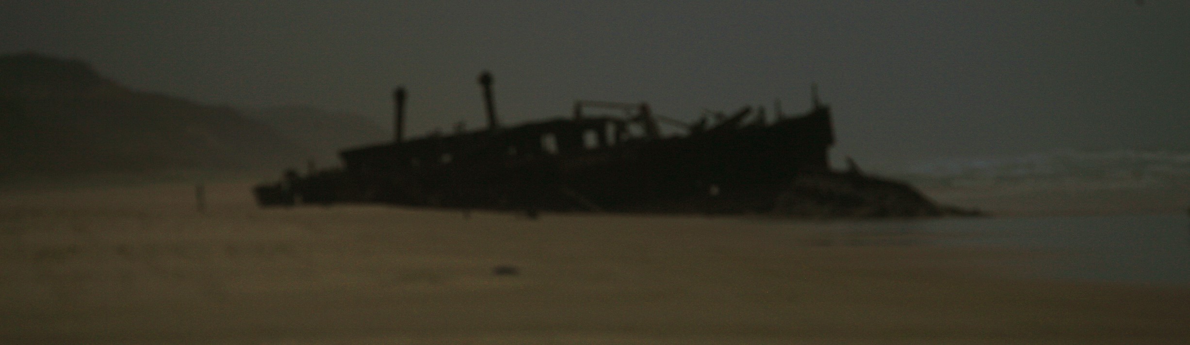
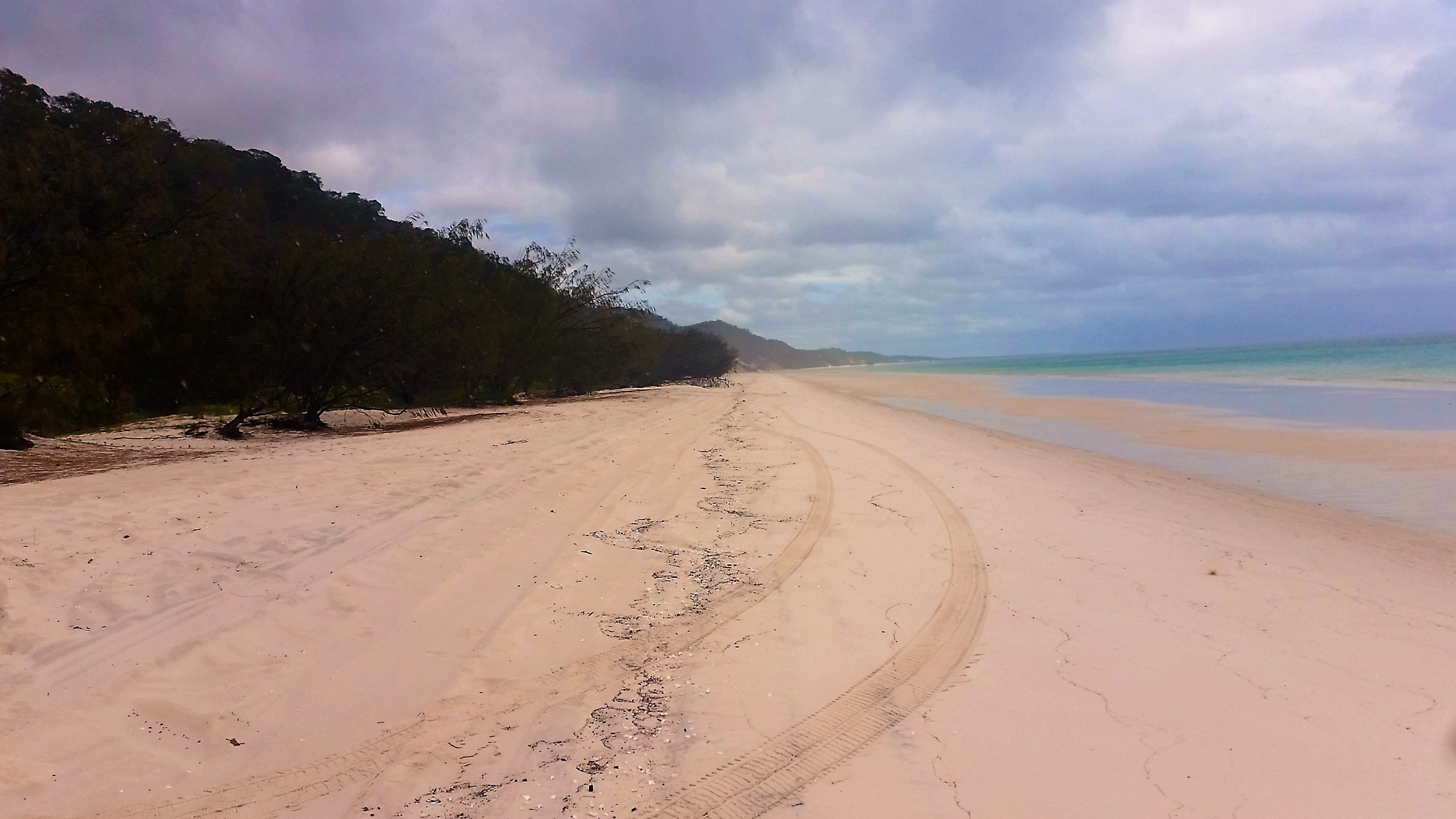
The Old Telegraph Track(OTT) is a very popular 4WD track that heads north up Cape York from Bramwell  Station to the Jardine river and beyond with the Telegraph terminating at Cable Beach near Punsand Bay, only 20km or so from the most northerly point of mainland Australia.

We left Morton Telegraph Station early, quickly drove 42km to Bramwell Station, keen but unsure what to expect at the first challenge Palm Creek.

A small wooden sign, not worthy of a photo pointed the track past the station and we pulled up at Palm Creek behind a big tour bus and a couple of other cars. Their eyes lit up and everyone reached for their cameras when we said we were going to cross.

It was certainly a bit more challenging than I was expecting but the word was if you can do this crossing you can complete the track. The entry into the creek was a two step, narrow muddy track with the tiniest bend towards the base. Total drop was possibly ten metres.

With other people arriving behind I jumped to it, handed cameras and video to people and started the GoPro running.

In the excitement of the moment I then made a number of rooky errors. Firstly, the GoPro was in camera mode so I got a photo of me looking at the camera – oops. Secondly, feeling the pressure of people waiting to cross I forgot to reduce my tyre pressures.

The descent was relatively easy as you just have to get your tyres in the tracks and keep them there while descending in low gear. The opposite side offered two exits and we chose the direct one. Naively thinking we could savour the moment with a slow ascent, I underestimated the traction on the slippery incline and sheepishly descended backwards after getting only the car nose to the top. On the next attempt I made my third error trying to ascend before the low range gear had engaged properly. The third time I beckoned to Amanda to grab the winch, put it round the nearest tree and 5 minutes later we were out. The tourist bus was happy with the spectacle but it was a very amateur effort indeed as the next cars showed us, roaring past in one attempt.

The ice was broken and we were on our way at last. Three kilometres later we arrived at Dulcie Creek, where track notes indicated care required to avoid deep holes. A muddy puddle sat in the middle of an otherwise dry river bed so this obstacle was passed with relative ease.

Dulhunty and Bertie rivers provided more water but these were more a case of avoiding deep holes in the rocky bed, nothing a quick wade in the crystal waters couldn’t solve.

One thing we did notice was that there are very few intact telegraph poles remaining. Souvenir hunters have bent the metal poles to remove the porcelain insulators along the entire track. There were some older wooden poles standing but these too lacked any porcelain adornments. They would look more impressive on the poles than sitting forlornly on people’s

The infamous challenge on the OTT is Gunshot Creek and we chose not to do this challenge as we were towing a fully laden Camprite trailer that we still needed to live in for some time. We bypassed this and setup camp at Cockatoo Creek, another crossing where deep holes in the riverbed need to be treated with respect. We camped above a deep waterhole and the kids spent the afternoon fishing and swimming. I spotted a big barramundi whilst spotlighting that night, and a quick well placed cast landed a 70cm fish for the next evening’s dinner.

Up early in the morning I took Oscar for a fish, still seeking his first barramundi, and landed a 72cm Sarotoga on my second cast. Unfortunately Oscar only caught some good-sized grunter. We also got a visit from the rare Palm Cockatoo which is a magnificent bird with a huge beak, black with red cheeks and a huge array of long feathers on his head.

So far the Camprite trailer was holding up very well and all was good. As the sun rose we prepared for as visit to Gunshot Creek.

Categories: 4WD, Adventure, australia, Australian Outback, Big Lap, Camper Trailer, Discover Australia, Explore Australia, Fishing, Journey Narrative, Kids Travel, Mitsubishi, Offroad, Photography, Photos, QLD, Queensland, Road trip, Travel, Travel Adventure | Tags: , , , , , , , , , | 1 Comment

Undara Volcanic National Park

This slideshow requires JavaScript.

With no barramundi bagged in Karumba, after fishing the incoming tide for a couple of hours, it was time to move on. I consoled myself with the fact that no-one else had caught anything either. With half the day gone it was a rush to get to Mount Surprise close to Undara. Flocks of brolgas lined the road as we left Karumba.

Brolga

Cumberland chimney

Cumberland chimney

Intrigued by a large chimney rising above the trees, we took a quick stop at the remains of the town of Chamberlain, close to Georgetown. The chimney is all that remains of a once prosperous gold producing town in the 19th century. The adjacent dam still flourishes though, so we had a break for some birding.

A brief stop then at Georgetown to visit the famous gem collection in the visitor centre was stifled by a grumpy lady. She gruffly stated that it was $8 each and she would be closing in 15 minutes so we’d have to come back tomorrow. We hoped she might have said we could look around for a few dollars but it wasn’t to be.
The longest lava flow from a single volcano on the Earth’s surface can be found at Undara Volcanic National Park, some 260km south-west of Cairns. Formed some 190,000 years ago, not very old in geological terms the lava flows took place over a period of 18 months and stretched up to 160km in some directions. Today there are 69 tubes that have been found and nine of these are accessible to the public. The tubes formed where there was an optimal gradient that allowed molten lava to follow the course of a creek bed slowly enough that the surface could cool and solidify whilst inside lava continued to flow through. Many of the ceilings of these tubes have collapsed in subsequent years but those that exist can be explored on guided tours.

On the bush walk to the tubes we followed the course of a collapsed tunnel, and saw how dry sclerophyll savannah became tropical vine thicket in the river bed. Bottle trees, some over 200 hundred years old emerged out of the thicket, standing proudly above the canopy, though being deciduous and with no leaves they appeared to be dead. Axe marks on one particularly old tree were testament to how aborigines used to climb them to collect the seeds which were then ground into a flour for cooking.

The highlight of our tour was the Wind Tunnel, approximately 200m long, with resident bent wing bat colony. Unfortunately, the tour guide had a deadline to meet and I didn’t have as long as I would have liked taking photographs.

It was mid-afternoon by the end of our tour so we had to find a camp quickly, resorting to a quaint little rest stop on the Archer river. The river was full of sooty grunty, then as the stars appeared in the cooling evening a creature that we guessed, from only a few glimpses, to be a bandicoot scurried feverishly through the long grass on the perimeter of the camp. Later that night a larger visitor rudely awoke me as it rummaged through a waste bag on the kitchen, a brushtail possum. Reluctant to leave he approached me first, peering into the tent then as I emerged it made a hasty retreat up the nearest tree.

Categories: Adventure, australia, Australian Outback, Big Lap, Discover Australia, Explore Australia, Journey Narrative, Kids Travel, National Park, QLD, Queensland, Road trip, Travel, Travel Adventure | Tags: , , , | Leave a comment

Boudjamulla National Park (Lawn Hill)

Riversleigh is a world heritage site based on the abundance of unique fossil deposits found there. To get there we had a relatively short drive from our camp at the O’Shaughnessy River, two short, shallow, but surprisingly slippery river crossings, and the obligatory corrugated rocky dirt road that makes the outback what it is. Whilst it appears to be an unremarkable spot on the surface, the signs provided allow visitors to look past the dusty, dry rocky landscape. For even the more imaginative visitor visualisation of the change in landscape over millions of years is challenging as the fossil record represents eras of marine reef, through to swamps when giant 4m freshwater crocodiles were the apex predators, and then elephant birds whose enormous size meant they couldn’t fly.

One fossil in the rock exposed a cross section of a turtle shell thought to be long extinct, however, as recently as 1995 the gulf snapping turtle was rediscovered in the Lawn Hill river system, thriving as it has done for thousands if not millions of years without change.

A short drive from this hot arid, fly-ridden place brought us to the oasis that is Boudjamulla National Park. The deep gorge and pandanus-lined river is a verdant oasis for fish and birdlife. Water levels were low and the Cascades had no water flowing over them, however the Indarri Falls, less than a kilometre upstream, spilled beautiful green, warm, lime-saturated water into the gorge. The water turbulence at the falls causes a gaseous release of carbon dioxide and the “tufa”, as it is called, is deposited at a surprising rapid rate, 2-3cm annually. The falls are not large, less than 3m in height, and covered in pandanus growth. Below the falls barramundi and turtles abound and we all spent hours exploring every nook and cranny.

The park also offers a number of bushwalks. The Wild Dog Dreaming track leads you along the river bank to a cliff face covered in ancient petroglyph art and more recent Waanyi rainbow serpent artwork. Island Stacks offered a walk on the limestone escarpment above the gorge, but the longest walk up the gorge was closed due to the threat of a grumpy buffalo that had recently been spotted up there.

All the forests were busy with birds and we spotted a pair of large channel-billed cuckoos near the trailer, and a whistling kite’s continual call gave away it’s nest site above the river, high in the outreaching limbs of a Eucalypt tree.

Canoes could be hired to explore but there was no need, and one day we made the decision to swim the one plus kilometre back to camp through the gorge, while Amanda carried our clothes back. The kids jumped on their inner tubes (presents from our friends at Marree Hotel so long ago now) and conquered the journey in no time at all.


Categories: Adventure, australia, Australian Outback, Big Lap, Camper Trailer, Discover Australia, Explore Australia, Journey Narrative, Kids Travel, National Park, Natural World, Photography, Photos, QLD, Road trip, Travel, Travel Adventure, Walks, Wildlife | Tags: , , , | 4 Comments

Blog at WordPress.com.

%d bloggers like this: