Road trip

Cape York, The Tip (Part 1)

Firstly thanks to all the responses helping with my computer. It probably won’t be fixed until we get home which means blogging will be less frequent and probably fewer photos for a while.

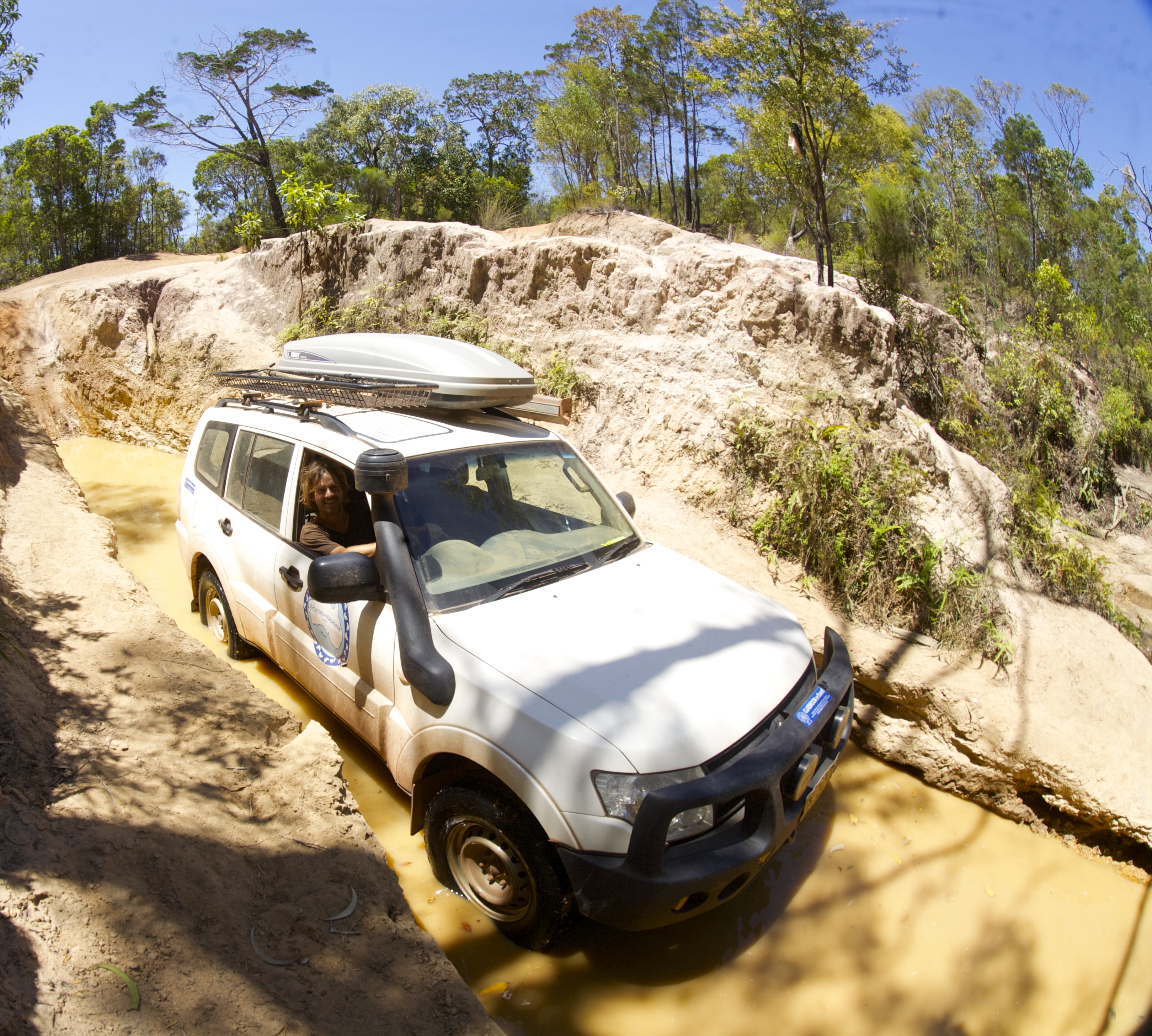
After decamping from the beautifully tranquil Jardine River a short but very corrugated drive brought us to the ferry crossing where the 20m crossing costs you $129 and lasts barely a couple of minutes. It sounds expensive but is a return fare and does include the permit to enter the indigenous area as well as camping in designated areas around the tip of Cape York.

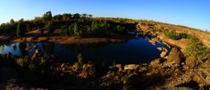
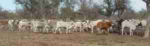
Bamaga is a sleepy township in the far north, offering a decent sized supermarket, post office, tavern, bakery and general store amongst others. A hasty re-fuel and restock and we headed 35km to the north easterly point of the Cape, to a campsite called Somerset. The Somerset Homestead is now in ruins, established in 1863 by John Jardine, farmed cattle, copra and had other commercial interests that included involvement in the pearling industry. Near to the campsite there are some old cannons, gravesites and some derelict ruins providing the inquisitive with a glimpse into the hardships of the past here. Fragments of old hand-blown black glass bottles can be found scattered in the bush, many dating back to the late 19th century.

Along the shoreline, behind the mangroves you can also find the remains of an old freshwater spring that was pooled as salvation for shipwrecked sailors, and graves of Japanese pearl divers.

Also along the shoreline, after negotiating crocodile infested mangroves and climbing the sharp rocks some remarkable indigenous art can be found in a cave, considerably pre-dating the homestead. Figures of fish, crocodiles and turtles, as well as other unidentifiable shapes were all clearly visible.

Some 900m away the large island of Albany offers fishing charter holidays, but has untouched beaches covered in turtle tracks with crystal clear water. The island also offered some protection from the prevailing onshore winds that greeted us all the way up the east coast of the Cape.

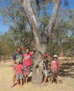
We explored the neighbouring coastline taking the five beaches track that weaves southwards through the bushland between beaches. We met another family with kids at SDEPS (whom we hadn’t seen for months) and took the photo at Fly Point of all the 8 kids. At the end of the track we found tracks that kept going and we explored at least two more beaches, the kids finding plenty of their new favourite shell, the chambered nautilus. Surprisingly there was less rubbish on the beaches here, probably because of the protection from Albany island.

Yellow-bellied sunbird

Yellow-bellied sunbird

The abundant and unique birdlife at the tip of the Cape York also provided an interesting diversion at dawn whilst everyone else was still waking up. The tally is now fast approaching 300 species on the trip and favourite birds have been changing regularly. Here the yellow-bellied sunbird was a welcome treat around the trailer.

This slideshow requires JavaScript.

The next day we had a challenge to meet, the third compass extremity of the mainland, Australia’s most northerly point. The dirt road wasn’t too bad, weaving at times through lush rainforest, before opening up at the beach. A short walk over the craggy headland past enormous rock cairns brought us to a very unimpressive simple sign at the northerly tip. Three down one to go!

Categories: 4WD, Adventure, australia, Australian Outback, Beach, Big Lap, Journey Narrative, Natural World, Photos, QLD, Queensland, Road trip, Travel, Travel Adventure, Wildlife | Tags: , , , , | 4 Comments

The Old Telegraph Track, Cape York (Part 4)

Having had time to check the vehicles were ok and contemplate how we would complete the river crossings on our last day on the Old Telegraph Track (OTT), we left with mixed emotions. I was excited at the prospect of quite a few challenging water crossings, Simon was more concerned, suggesting he might not accompany us the whole way, and Amanda displaying some trepidation at the prospect of having to do this “solo”.

This slideshow requires JavaScript.

The first ten kilometres beyond Eliot offer three water crossings and a log bridge crossing then beyond that Nolans Brook offers the deepest crossing on the track, often over one metre in depth. Simon had also heard of another crossing, Logans Creek, innocuously labelled as a ford on the map, that was reputedly as deep as Nolans Brook. We decided to assess each crossing before progressing.

All electronic gear had been moved as high as possible in the car, and recovery gear made easily accessible for this day. Amanda seemed to think water would be flooding through both car and trailer so had moved essential clothing to a safe height too. Really? We are not driving a sieve! I cut up a tarp to cover the radiator to help create a bow wave when crossing deeper water too. We also wanted an early start so we got a good look at crossings before they were silted up by traffic. Most clear pretty quickly but we wanted to be sure.

Canal Creek was fairly straightforward, avoiding the deep sections then crawling up a steep section on the far bank. Then Sam Creek and Mistake Creek past with no incident, the challenge being avoiding potholes and steep entry/exit points.

The log bridge at Cypress Creek didn’t look too bad until half way across when loud wooden cracking noises sounded beneath the car. Knowing that we were a tad overweight a touch on the accelerator got us quickly across before anything collapsed beneath.

Arriving at Cannibal Creek I had flashbacks to Palm Creek. A steep descent into the creek looked fine but a deceptive steep drop off the rock platform into the creek was unavoidable, followed by a horseshoe turn across the thigh-deep creek and a steep exit. It would be difficult to exit back out should Logans or Nolans Brook prove to much of a challenge, and at this point Simon and Hilary reluctantly chose to turn back and take the deviation road but I felt we could still do it. As a result most of the coverage is video format rather than photos

The rock drop-off took its toll as one of the support struts was broken of the Camprite. Not a critical part and easily fixable when we return it was put in the car and off we went, Simon offering to provide support at Nolans Brook from the opposite bank when he got there.

Very soon we arrived at Logans to find a deep channel and an ankle deep crossing so we took the easy route. Then came the signs offering towing and recovery assistance, so we knew we had arrived at Nolans. A quick wade proved it to be waist deep but I was confident the Pajero and Camprite would easily do it. Just in case I rigged up the winch and a strap.

This slideshow requires JavaScript.

Just as I jumped into the car a car pulled up behind us and two guys jumped out with cameras. I could see dust clouds not far behind indicating further traffic arriving. I took off before they arrived keeping hard to the right of the main crossing, the bonnet sinking fast, but seconds later I emerged, pulled out of the creek, pulled over, left the engine running and checked for water – nothing inside.

By the time I walked back to the creek 7 cars were lined up waiting to cross. Apparently our early passage had caused everyone to quickly pack up to avoid having to cross in softer sand as more vehicles pass through. The fourth car, a Landcruiser took the central line, briefly disappeared and only partially re-emerged from the water. Stuck in two-wheel drive it needed a tow to exit and as he did the doors were opened to let water gush out from the front and back doors – lovely to watch especially as it wasn’t us. They hadn’t moved the shopping bags off the floor either which could have been disastrous.

Everyone cracked open a celebratory beer once over the creek except for me, who had run out a few days prior. It is actually quite hard to buy alcohol in Cape York and there are strict restrictions to protect the local indigenous communities.


We all jumped into the creek for a swim and the kids made the most of a rope swing over the water while we waited for Hilary and Simon to arrive from the opposite side. We had lunch at Nolans then convoy again we drove north to the Jardine River to our camp on the south side. We camped at what used to be the river crossing but after too many people got eaten by crocodiles attempting the crossing, a ferry crossing to the west was mandated. Looking at the crossing at the end of a very dry year I believe we could have made it but was happy to go swimming in the water with the kids instead. That may sound dangerous but we always send the kids in first to be sure it’s safe!

The Jardine River was approximately 50m wide here, with gin clear water flowing up to a metre over sand. It was delightful to see such a major waterway in pristine condition. Birdlife again was bountiful with kingfishers, a fawn-breasted bowerbird, honeyeaters and many more inhabiting the forest and scrub close to the river.

Clouds formed in the sky and threatened rain but at the end of the day we had a gorgeous campfire on the riverbank with 110 around Oz and talked about the OTT and our other journeys to date.

Categories: 4WD, Adventure, australia, Australian Outback, Big Lap, Discover Australia, Explore Australia, Journey Narrative, Kids Travel, Mitsubishi, National Park, Offroad, Photography, Photos, Queensland, Road trip, Travel, Travel Adventure | Tags: , , , , , , , , , | Leave a comment

The Old Telegraph Track, Cape York (Part 3)

Following the fun at Gunshot Creek watching others trying to avoid breaking their cars it was time for us to have some fun as we headed to Fruit Bat Falls and Eliot Falls. Less than 30km north we turned off to Fruit Bat Falls for an early morning swim before the crowds arrived. The river is fairly shallow running over a rock platform then drops a couple of metres per the falls into a sandy pool below, great fun for swimming with the kids.

This slideshow requires JavaScript.

Sufficiently cooled off we decide to head to the camp at Eliot Falls for lunch. 12km away we had heard the road had a particularly deep crossing, marked innocently as a ford. Scrubby Creek as it is known was silted up on arrival so we had to wade it, water levels reaching the thigh, deeper in the middle. After watching cars go through on both sides we crossed without trauma, sticking to the one side. The park itself sits on the edge of the Jardine River National Park and Heathlands Regional Park. At Eliot there are three main waterholes called the Saucepan, Twin and Eliot falls. The former was a deep section of the Eliot river with cascades into it, allowing older kids to jump from the sides. Twin Falls was more picturesque with a series of small waterfalls into sandy bottomed shallow pools, fed from Canal Creek and more suitable for younger children. The clarity of the water proved popular with our kids as they fossicked for stones in the river bed. Pitcher plants, sundews and bladderworts, all insectivorous plants lined the riverbanks, testament to the nutrient poor soil on and around the limestone rock.

Eliot Falls themselves were the biggest falls offering 3m jumps into the middle of the horseshoe shaped falls. Below the falls deep rocky sections flowed rapidly over large boulders offering lap pool alternatives, swimming into the current. Where the two rivers meet it was noticeably warmer water coming from Canal Creek.

We spent two days here relaxing with plenty of swimming to cool us from the searing heat. For such a popular spot it was a shame to have no visible Park Ranger presence whilst we were there. People had dogs in the park, generators on at night, people ripping down trees in the campground for firewood, and Simon and Hilary even spotted people soaping up ready to wash in the rivers. It won’t be long before it becomes a lot less attractive if Queensland Parks don’t raise their game, focus on the site preservation rather than the ridiculous online camping booking system aimed at revenue raising rather than customer experience. The city-dwelling consultants who sold that one to the government should be ashamed of themselves as they clearly don’t understand how travellers operate. Maybe another blog for that one!


Categories: 4WD, Adventure, australia, Australian Outback, Big Lap, Discover Australia, Explore Australia, Journey Narrative, Kids Travel, National Park, Natural World, Offroad, Photography, Queensland, Road trip, Travel, Travel Adventure | Tags: , , , , , , | Leave a comment

The Old Telegraph Track, Cape York (Part 2)

Having made the decision not to risk trailer and car at Gunshot Creek, we had bypassed to the camp at Cockatoo Creek, some 10km north, then drove back hoping to see less conservative people prepared to risk their vehicles.

This slideshow requires JavaScript.

It was quiet when we arrived with only another family there awaiting some action. We walked down to the creek where the Hall of Fame tree lies adorned with wreckage from the cars that didn’t make it, bragging notices and a lot of rubbish. On one side there are three main crossings, No.1, the original path offering a vertical drop some 3-5m into a muddy pool. With only centimetres either side of the car it leaves no margin for error and only the brave or foolhardy attempt this. Ferns grow out of the cliff walls on either side. No.2 and No.3 are not much different, offering only slightly less than vertical entries, with longer deep muddy exits. On the other side some 4 or 5 “chicken” options are available where the car’s entry can be controlled to a certain degree. We ended up seeing two cars do this side before we left, both performing the crossing relatively effortlessly, though the first Patrol lost both taillights on the descent. The secret to an easy crossing appeared to be suspension lift and large mud tyres. Without these a winch is the necessary accessory to get out.

Sizing up No.2

Sizing up No.2

No.1 birds eye view

No.1 birds eye view

It was only later that we discovered we missed out seeing the five cars that completed No.2 later in the afternoon when they turned up at camp in the evening.

Categories: 4WD, Adventure, australia, Australian Outback, Big Lap, Camper Trailer, Challenges, Discover Australia, Explore Australia, Journey Narrative, Kids Travel, Mitsubishi, Offroad, Queensland, Road trip, Travel, Travel Adventure | Tags: , , | Leave a comment

The Old Telegraph Track, Cape York (Part 1)

With the Lenovo seeming dead I have adopted an Apple to continue blogging!

This slideshow requires JavaScript.

The Old Telegraph Track(OTT) is a very popular 4WD track that heads north up Cape York from Bramwell  Station to the Jardine river and beyond with the Telegraph terminating at Cable Beach near Punsand Bay, only 20km or so from the most northerly point of mainland Australia.

We left Morton Telegraph Station early, quickly drove 42km to Bramwell Station, keen but unsure what to expect at the first challenge Palm Creek.

A small wooden sign, not worthy of a photo pointed the track past the station and we pulled up at Palm Creek behind a big tour bus and a couple of other cars. Their eyes lit up and everyone reached for their cameras when we said we were going to cross.

It was certainly a bit more challenging than I was expecting but the word was if you can do this crossing you can complete the track. The entry into the creek was a two step, narrow muddy track with the tiniest bend towards the base. Total drop was possibly ten metres.

With other people arriving behind I jumped to it, handed cameras and video to people and started the GoPro running.

In the excitement of the moment I then made a number of rooky errors. Firstly, the GoPro was in camera mode so I got a photo of me looking at the camera – oops. Secondly, feeling the pressure of people waiting to cross I forgot to reduce my tyre pressures.

The descent was relatively easy as you just have to get your tyres in the tracks and keep them there while descending in low gear. The opposite side offered two exits and we chose the direct one. Naively thinking we could savour the moment with a slow ascent, I underestimated the traction on the slippery incline and sheepishly descended backwards after getting only the car nose to the top. On the next attempt I made my third error trying to ascend before the low range gear had engaged properly. The third time I beckoned to Amanda to grab the winch, put it round the nearest tree and 5 minutes later we were out. The tourist bus was happy with the spectacle but it was a very amateur effort indeed as the next cars showed us, roaring past in one attempt.

The ice was broken and we were on our way at last. Three kilometres later we arrived at Dulcie Creek, where track notes indicated care required to avoid deep holes. A muddy puddle sat in the middle of an otherwise dry river bed so this obstacle was passed with relative ease.

Dulhunty and Bertie rivers provided more water but these were more a case of avoiding deep holes in the rocky bed, nothing a quick wade in the crystal waters couldn’t solve.

One thing we did notice was that there are very few intact telegraph poles remaining. Souvenir hunters have bent the metal poles to remove the porcelain insulators along the entire track. There were some older wooden poles standing but these too lacked any porcelain adornments. They would look more impressive on the poles than sitting forlornly on people’s

The infamous challenge on the OTT is Gunshot Creek and we chose not to do this challenge as we were towing a fully laden Camprite trailer that we still needed to live in for some time. We bypassed this and setup camp at Cockatoo Creek, another crossing where deep holes in the riverbed need to be treated with respect. We camped above a deep waterhole and the kids spent the afternoon fishing and swimming. I spotted a big barramundi whilst spotlighting that night, and a quick well placed cast landed a 70cm fish for the next evening’s dinner.

Up early in the morning I took Oscar for a fish, still seeking his first barramundi, and landed a 72cm Sarotoga on my second cast. Unfortunately Oscar only caught some good-sized grunter. We also got a visit from the rare Palm Cockatoo which is a magnificent bird with a huge beak, black with red cheeks and a huge array of long feathers on his head.

So far the Camprite trailer was holding up very well and all was good. As the sun rose we prepared for as visit to Gunshot Creek.

Categories: 4WD, Adventure, australia, Australian Outback, Big Lap, Camper Trailer, Discover Australia, Explore Australia, Fishing, Journey Narrative, Kids Travel, Mitsubishi, Offroad, Photography, Photos, QLD, Queensland, Road trip, Travel, Travel Adventure | Tags: , , , , , , , , , | 1 Comment

Undara Volcanic National Park

This slideshow requires JavaScript.

With no barramundi bagged in Karumba, after fishing the incoming tide for a couple of hours, it was time to move on. I consoled myself with the fact that no-one else had caught anything either. With half the day gone it was a rush to get to Mount Surprise close to Undara. Flocks of brolgas lined the road as we left Karumba.

Brolga

Cumberland chimney

Cumberland chimney

Intrigued by a large chimney rising above the trees, we took a quick stop at the remains of the town of Chamberlain, close to Georgetown. The chimney is all that remains of a once prosperous gold producing town in the 19th century. The adjacent dam still flourishes though, so we had a break for some birding.

A brief stop then at Georgetown to visit the famous gem collection in the visitor centre was stifled by a grumpy lady. She gruffly stated that it was $8 each and she would be closing in 15 minutes so we’d have to come back tomorrow. We hoped she might have said we could look around for a few dollars but it wasn’t to be.
The longest lava flow from a single volcano on the Earth’s surface can be found at Undara Volcanic National Park, some 260km south-west of Cairns. Formed some 190,000 years ago, not very old in geological terms the lava flows took place over a period of 18 months and stretched up to 160km in some directions. Today there are 69 tubes that have been found and nine of these are accessible to the public. The tubes formed where there was an optimal gradient that allowed molten lava to follow the course of a creek bed slowly enough that the surface could cool and solidify whilst inside lava continued to flow through. Many of the ceilings of these tubes have collapsed in subsequent years but those that exist can be explored on guided tours.

On the bush walk to the tubes we followed the course of a collapsed tunnel, and saw how dry sclerophyll savannah became tropical vine thicket in the river bed. Bottle trees, some over 200 hundred years old emerged out of the thicket, standing proudly above the canopy, though being deciduous and with no leaves they appeared to be dead. Axe marks on one particularly old tree were testament to how aborigines used to climb them to collect the seeds which were then ground into a flour for cooking.

The highlight of our tour was the Wind Tunnel, approximately 200m long, with resident bent wing bat colony. Unfortunately, the tour guide had a deadline to meet and I didn’t have as long as I would have liked taking photographs.

It was mid-afternoon by the end of our tour so we had to find a camp quickly, resorting to a quaint little rest stop on the Archer river. The river was full of sooty grunty, then as the stars appeared in the cooling evening a creature that we guessed, from only a few glimpses, to be a bandicoot scurried feverishly through the long grass on the perimeter of the camp. Later that night a larger visitor rudely awoke me as it rummaged through a waste bag on the kitchen, a brushtail possum. Reluctant to leave he approached me first, peering into the tent then as I emerged it made a hasty retreat up the nearest tree.

Categories: Adventure, australia, Australian Outback, Big Lap, Discover Australia, Explore Australia, Journey Narrative, Kids Travel, National Park, QLD, Queensland, Road trip, Travel, Travel Adventure | Tags: , , , | Leave a comment

Next stop Kurumba (Via Burketown and Normanton)

Having covered quite a few kilometres recently and being behind in my blog due to having no telephone coverage for days on end I had to dig out the map to recall this one!

Preferring the road less travelled we chose to head north from Boudjamulla National Park towards the Savannah Way and this plan proved way more challenging than it should have been. We got into the habit of opening and closing gates behind us as the road continued but when I looked up after one gate, having driven a hundred metres into the centre of a monstrous herd of cattle, it became obvious the only tracks were those of the cattle. What made it somewhat amusing was the fact that we were still being followed by a very trusting couple of backpackers who had asked us directions, and obviously accepted our confidence. At that moment a stockman drove past on the opposite side of the fence with a freshly killed cow strapped to the back of his UTE. I casually pushed past the cows towards him trying not to look like a goose, but he must have been killing himself with laughter and after a brief polite exchange of pleasantries he put us back on the right track closing with “If you keep going this way you can drive for a week without seeing anything”. Sure he was exaggerating but point made both cars exited the paddock quickly.

With no further significant events the next stop was Bourketown after a very dreary stretch of the Savannah Way. The land is so dry and overgrazed it is quite sad to see herds of cattle, ribs clearly visible, sitting under what little shrub, or tree, cover there remains offering shade, in what can only be described as a dustbowl landscape.

Bourketown has an artesian bore that leaves the ground at a scalding 68 degrees. Drilled as early as 1897, it was found to be suitable only for adult cattle to drink, and the CSIRO in 1959 decreed that it was unsuitable for domestic use, irrigation, the flow was uncontrolled and was leaking. The was a bath house here for a while but nowadays there is just a swampy ground frequented by wallabies and wading birds. The mineral content of the water is so rich that their deposits over the last hundred years have caused the bore to “grow” upwards into an impressive rock structure.

The Savannah Way onwards to Normanton yielded few more surprises or points of interest, however, the big crocodile was awaiting us in Normanton and the kids were getting excited. We chose to stop and camp at the Leichhardt River as we had covered quite some distance already and though the Leichhardt Falls were dry the camp spot was pleasant.

We had a quick fish and caught a shark, interesting as the river level was so low, not tidal here, and we were over 50km upstream from the Gulf of Carpentaria. An arafura file snake poked his nose out of the water, flicked his tongue to check us out then slipped back into the depths. A solid campfire on a crystal clear starry night was the perfect end to the day and I tried to take some long exposure shots. Does anyone know why I am getting different coloured light specks all over the images (no they aren’t the stars)?

A short 2km deviation off the final stretch of the Savannah Way to Normanton takes you to the spot where early explorers Bourke and Wills made camp 119. All but one of the party perished shortly after from starvation and/or malnutrition. The only survivor relied on aboriginal assistance and the tragedy of the story is that the aborigines consider this a fairly abundant region.

In 1861, a dash to the north coast was made from this, their most northerly camp, to the Gulf of Carpentaria. The people remaining at the camp passed their time creating blazes on surrounding tree trunks, and though many have died there are a few remnants remaining, the clearest probably being the Walker tree that was carved the following year after their expedition. Others are marked by a plain steel square nailed to the trunk, identified from early photographs and the distinctive blazes.

Krys the Savannah King was an 8.63m estuarine crocodile that was shot near Normanton in 1957. A supposedly replica statue is proudly displayed in the town centre, and whilst the length may be accurate it definitely seems that actual proportions may have been slightly exaggerated to create the beast that we went to marvel at. For those doubters, compare the photo of the hunter sitting on the corpse from 1957. Don’t get me wrong, 8+m long is huge, but that Normanton statue looks closer to a four-legged T-rex proportion. We had some fun there then pressed on to the Barramundi capital, Karumba. We have yet to bag a barramundi that we could eat!

Categories: Adventure, australia, Australian Outback, Big Lap, Discover Australia, Explore Australia, Journey Narrative, Kids Travel, Queensland, Road trip, Travel, Travel Adventure | Tags: , , , , | 2 Comments

Boudjamulla National Park (Lawn Hill)

Riversleigh is a world heritage site based on the abundance of unique fossil deposits found there. To get there we had a relatively short drive from our camp at the O’Shaughnessy River, two short, shallow, but surprisingly slippery river crossings, and the obligatory corrugated rocky dirt road that makes the outback what it is. Whilst it appears to be an unremarkable spot on the surface, the signs provided allow visitors to look past the dusty, dry rocky landscape. For even the more imaginative visitor visualisation of the change in landscape over millions of years is challenging as the fossil record represents eras of marine reef, through to swamps when giant 4m freshwater crocodiles were the apex predators, and then elephant birds whose enormous size meant they couldn’t fly.

One fossil in the rock exposed a cross section of a turtle shell thought to be long extinct, however, as recently as 1995 the gulf snapping turtle was rediscovered in the Lawn Hill river system, thriving as it has done for thousands if not millions of years without change.

A short drive from this hot arid, fly-ridden place brought us to the oasis that is Boudjamulla National Park. The deep gorge and pandanus-lined river is a verdant oasis for fish and birdlife. Water levels were low and the Cascades had no water flowing over them, however the Indarri Falls, less than a kilometre upstream, spilled beautiful green, warm, lime-saturated water into the gorge. The water turbulence at the falls causes a gaseous release of carbon dioxide and the “tufa”, as it is called, is deposited at a surprising rapid rate, 2-3cm annually. The falls are not large, less than 3m in height, and covered in pandanus growth. Below the falls barramundi and turtles abound and we all spent hours exploring every nook and cranny.

The park also offers a number of bushwalks. The Wild Dog Dreaming track leads you along the river bank to a cliff face covered in ancient petroglyph art and more recent Waanyi rainbow serpent artwork. Island Stacks offered a walk on the limestone escarpment above the gorge, but the longest walk up the gorge was closed due to the threat of a grumpy buffalo that had recently been spotted up there.

All the forests were busy with birds and we spotted a pair of large channel-billed cuckoos near the trailer, and a whistling kite’s continual call gave away it’s nest site above the river, high in the outreaching limbs of a Eucalypt tree.

Canoes could be hired to explore but there was no need, and one day we made the decision to swim the one plus kilometre back to camp through the gorge, while Amanda carried our clothes back. The kids jumped on their inner tubes (presents from our friends at Marree Hotel so long ago now) and conquered the journey in no time at all.


Categories: Adventure, australia, Australian Outback, Big Lap, Camper Trailer, Discover Australia, Explore Australia, Journey Narrative, Kids Travel, National Park, Natural World, Photography, Photos, QLD, Road trip, Travel, Travel Adventure, Walks, Wildlife | Tags: , , , | 4 Comments

The Plenty Highway

This slideshow requires JavaScript.

Alice Springs didn’t have the tyre we needed to replace our worn flat tyre so with no further reason to hang around we headed north up the Stuart Highway again to the junction with the Plenty Highway. This road is almost 500km long, predominantly unsealed, that provided us a relatively direct route into Queensland. Both the car and I are a little weary of corrugated dirt roads so this route offered a compromise. The road is also known for the mineral rich environment it passes through, and a random decision en route saw us pull in to the interesting named Gemtree caravan park.

The kids excitement levels rose when they saw there were tag-along gemstone tours for garnets and zircon so we duly booked up for the next day. The offer of a camp roast dinner that night proved too much too so that too was promptly booked. Then as we settled in to the site, each named after a gemstone, a cry went up that “110AroundOz” were in the camp, another Sydney family that we hadn’t seen for a while.

KatesCampKitchen

Kate and Arran, who run the park, won an award for their camp oven dinners in 2014. That evening Kate introduced her team and gave a thorough overview of the development and operation of the camp oven. The dinner was a well-oiled production line operation and the full-stacked plates that swiftly emptied were testament to the quality of the dinner. We have only had one roast dinner since we have been away so it was a real treat, particularly the beer keg-cooked spuds.

This slideshow requires JavaScript.

Early next morning the car was loaded with pick, shovel, sieves, bucket and a 20 gallon drum of water, and a small convoy followed our guide Greg along the dusty road, pulled off some kilometres later and arrived at an unremarkable spot. Greg demonstrated how to sieve the dug soil, and how to wash it and by looking through the base at the sun garnets can be identified by the blood red glow in the light. The fragments often looked like bits of broken glass, but we hit a good patch, and after a few hours we were the last to leave with a tin full of garnet fragments. Back at the park Kate examined and graded them, commenting that she had never seen so many cutting grade garnets found before. With our beady-eyed fossicking kids it wasn’t really a surprise.

Mulga ant hole

Mulga ant hole

The property also hosts zircon fossicking trips, but I chose to take the self-guided nature trail that highlights many of the native shrubs and trees and their medicinal or other uses. The mulga ant holes lined the walkway, supposedly a sign of impending rain, but little evidence of this being the case on any forecast I have seen. Although I didn’t see as many birds as were found in the camping area itself I was amused to find a few tees for what must once have been a golfing grand plan. From their condition I guessed that maintenance of a big course is actually quite hard and I couldn’t find any evidence of flags where the holes might have been.

Gemtree was truly a hidden gem that we were lucky enough to stumble upon. A few days earlier we never even planned to be in this neck of the woods.

From Gemtree the Plenty Highway provided lots of dust heading east, but the road itself wasn’t too bad. A particularly large termite mound by the side of the road provided a welcome opportunity to stop and let the kids try to scale it. Apparently the insides of the mound can be rubbed on the skin as a mosquito repellent, but you have to break into the concrete-like structures first.

Categories: 4WD, Adventure, australia, Australian Outback, Big Lap, Discover Australia, Explore Australia, Journey Narrative, Kids Travel, Northern Territory, NT, Offroad, Photography, Road trip, Travel, Travel Adventure | Tags: , | 3 Comments

Urandangie and beyond Mount Isa

This slideshow requires JavaScript.

Just before the Plenty Highway ends and becomes the Donohue Highway past the Queensland border, we turned left, at Tobermory. For the next 70km or so of unsealed dirt there were regular signs promoting the Urandangi pub. Not that we needed to be tempted but the only pub between Alice Springs and Mt Isa was an offer too good to refuse. Still the humorous signs kept coming at regular intervals with things like “Hot Dusty Road, Ice Cold Beer”, and “Skippy’s Retirement Home”, many on recycled car bonnets. As we approached the town of Urandangie, the car bonnets announced the river crossings and features of the area, “Sally’s Crossing”. “Wallace Rockhole”, “Bill’s Crossing”, “Dinner Camp”, and many more.

At the end of the hot day we pulled up at the pub. To my delight there was a tap of Guinness, but this was just another cruel joke because in a town where the population is 7 adults the demand is obviously not sufficient to justify keg beer. As we quaffed our drinks the publican brought out two loaves of bread for the kids to feed the horses. When they returned she led us all out through the pub, through her lounge and into the backyard where a mob of baby joeys pottered around. One particularly friendly one, Chat, who loved a scratch and a cuddle came up to the kids and grabbed them in a tight hold, awaiting a scratch under the neck. He became quite interested in my beard, grabbing it in both paws before landing a kiss on my lips before I could escape.

The town was established in 1885 and became a popular stop for drovers on the Georgina Stock route between Camooweal and Dajarra. Even Chinese migrants en route for goldfields stayed and worked here. The publican, Pam, provided us with an interesting summary of the history which provides a good read around the campfire.

This slideshow requires JavaScript.

We were then directed back down to the campsites near the river and established ourselves at Wallace Rockhole, where the pools of water looked promising to catch dinner. Unfortunately the only yabby we caught was returned unharmed as it would have only provided a snack for one!

The kids did find an inland python sitting on the rocks below the camp. Another beautiful starry night around the campfire was followed by a morning threatening rain. Dark clouds gathered from the West and a rainbow appeared nearby, but as we headed north towards Mt Isa we left it behind. A cattle muster crossing the road provided a temporary diversion from the unsealed monotony of driving.

Muster on the road

Muster on the road

Mustering in progress

Mustering in progress

We were greeted by a huge power plant at Mt Isa, and knowing the Queensland National Parks have online bookings we thought it prudent to book a place at Boodjamulla National Park (Lawn Hill). After a lengthy process, more painful than pulling a tooth we found there was only one site we could book for three consecutive nights. Simon booked three different tent sites and we agreed to sort it out on arrival. Funnily enough we never seem to stop long in the big towns to explore and as soon as we have refuelled, restocked supplies we tend to head out as quickly as we can.

With the park 390km away we found a beautiful free camp by the O’Shaughnessy river on the way, arrived late in the afternoon for a quick refreshing dip, another campfire and marshmallows for the kids and the melodic bubbling of the river the next to the camp very quickly helped everyone fall asleep very quickly after another long day’s driving.

O'Shaughnessy river cascades and crossing

O’Shaughnessy river cascades and crossing

Categories: Adventure, Animal Action, australia, Australian Outback, Big Lap, Discover Australia, Explore Australia, Journey Narrative, Kids Travel, Photography, Queensland, Road trip, Travel, Travel Adventure | Tags: , , | 1 Comment

Blog at WordPress.com.