Discover Australia

Back to the Atherton Tablelands


Lumholtz Tree Kangaroos

Lumholtz Tree Kangaroos

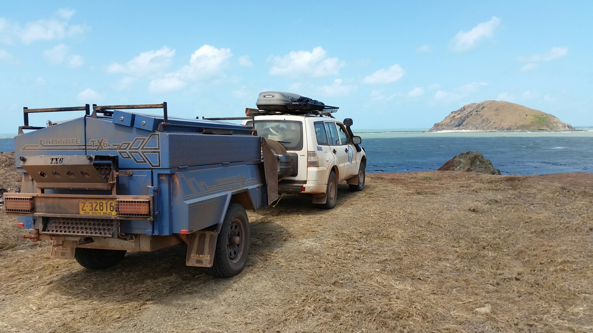
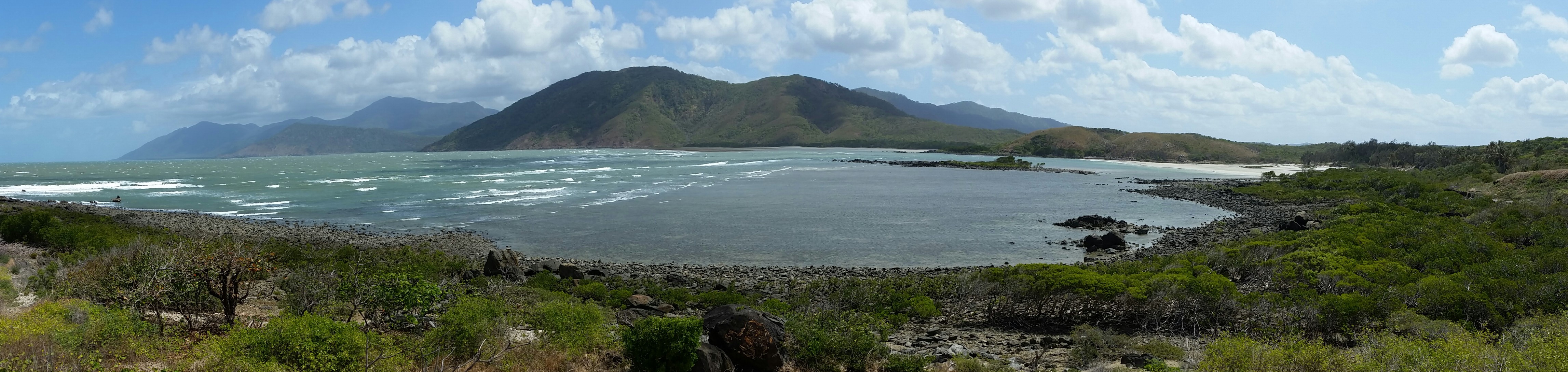
After a quick trip into Cairns to pick up mail we headed for the hills again. Having not spent much time in the Atherton Highlands we chose to explore a little deeper this time and took the steepest, most windy road available. Well it wasn’t planned that way! The direct road from Cairns to the highlands rose over 900m snaking its way up from Gordonvale to Yungaburra. The glimpses back towards the sea were amazing however I needed to watch the road carefully to avoid mishap. We sneaked a peak at Lake Barrine but with sleeping kids in the back we pressed on to Millaa Millaa which was our planned base for a few days.

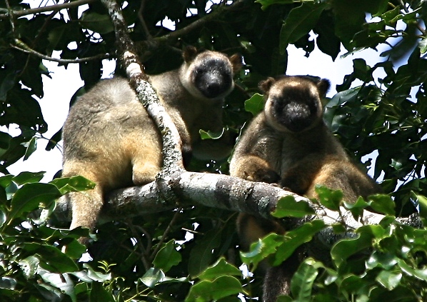
Hoping to spot a few new birds I got up early to explore the neighbourhood and spotted two Lumholtz tree kangaroos, about 500m down the road on the edge of the village. The long dangling tails were a giveaway and the beautiful animals resembling oversize teddy bears even put on their best poses for me.

We drove the waterfall circuit that incorporates Millaa Millaa falls, supposedly the most photographed falls in Australia, Zillie and Elinjaa falls too.

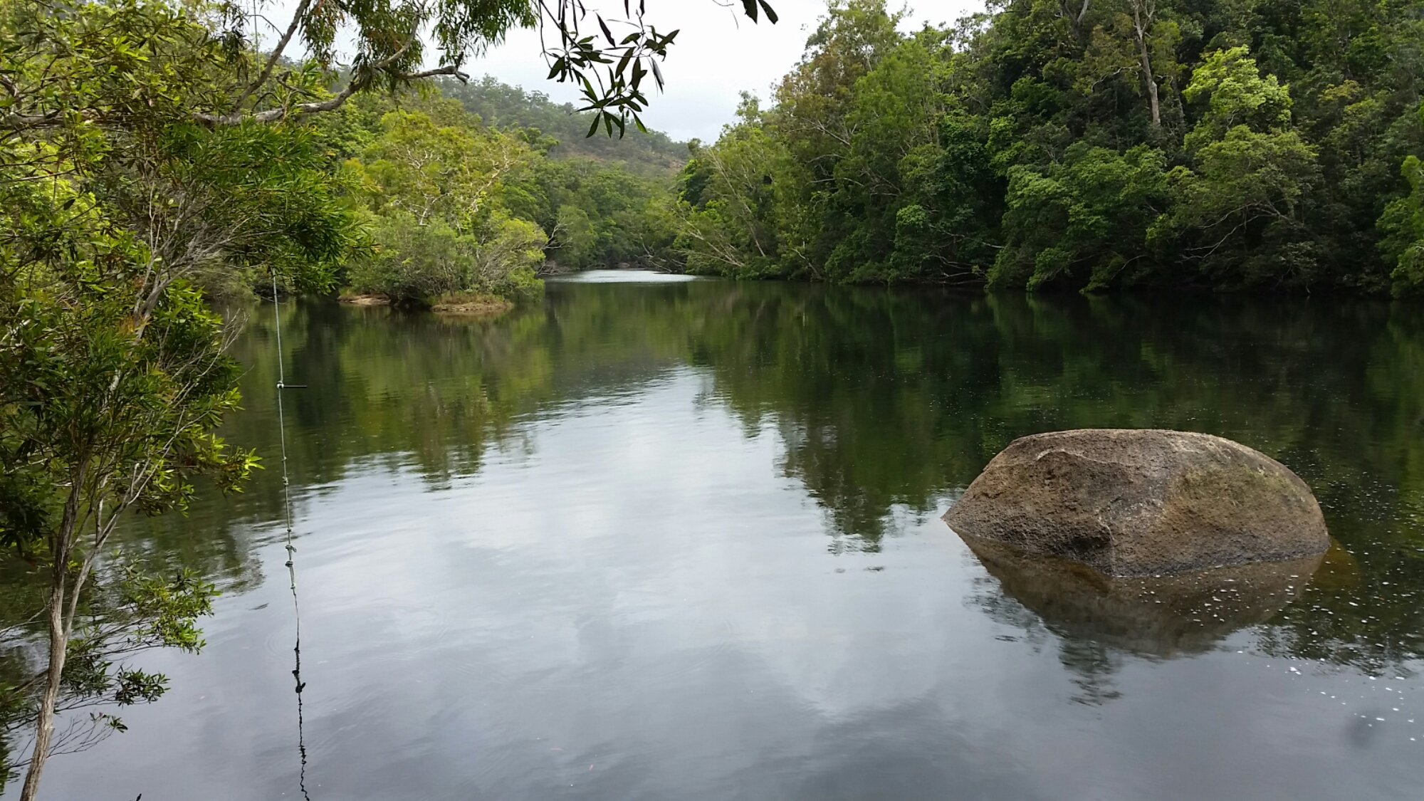
The forests surrounding nearby Lake Eacham were alive with new birdsong and I was lucky enough to find tooth-billed bowerbirds and spotted catbirds, the former having a very untidy bower made of overturned leaves in a scraped area. The Lake itself is a a crater lake formed from the explosive reaction of magma meeting the water table. Steep sides descend up to 65m into the deepest part of the lake and the old established rainforest make an interesting bush walk, past, even through, at times, large fig trees whose roots and buttresses clasp on to the sides of the crater.

We also saw the 500 year old Curtain Fig, whose root system appears to cascade from the skies. We revisited Mount Hypipamee National Park to see the Crater Lake that we’d missed previously. This crater was formed by a volcanic gas explosion, the granite walls today being sheer and some 70m across. The lake lies almost 60m below the rim and is 70m deep. This park often has cassowary sightings but not when we visit.

We visited a couple of dairies, the Gallo Dairyland one proving to be the favourite. The cheese and chocolate tastings proved irresistible and we came home clutching an array of mouth-watering produce. The tea farm was a bit of a disappointment as the factory was being cleaned and the tea-room didn’t offer any tastings. We did spot another tree kangaroo though there.

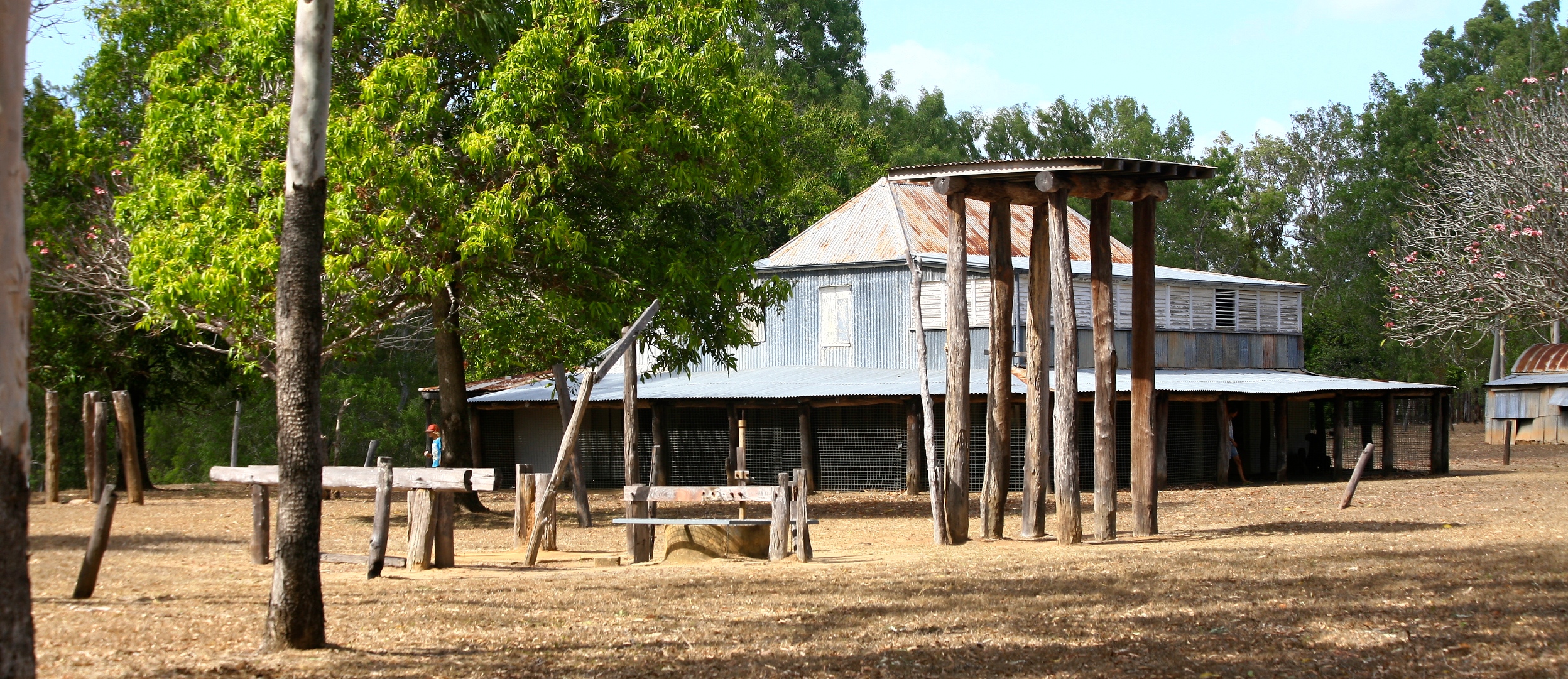
There was so much to do we extended our stay, and even as we left we had to explore the Millaa Millaa museum before leaving. Behind the museum is the trunk of an almost 900 year old Kauri pine that fell in a storm in 2003. The timber industry thrived here for many years and the museum is full of artefacts from those times.

The Atherton Tablelands provided a much more interesting experience than the coastal commercialised tourism, offering so much variety of things to do. Once again it felt like we had barely scratched the surface, but were busy from the moment we arrived. All downtime back at camp was spent catching up with schoolwork but the few days we were there felt like we had achieved a lot.


Categories: Adventure, australia, Australian Outback, Big Lap, Discover Australia, Explore Australia, Journey Narrative, National Park, Natural World, Photography, Photos, Queensland, Road trip, Travel, Travel Adventure, Walks, Wildlife | Tags: , , , , , , , , , | 2 Comments

Roaring Meg, Bloomfield and Cape Tribulation

Pool upstream from Roaring Meg falls

Pool upstream from Roaring Meg falls

With balding tyres, worn brakes and a car desperately in need of another service I wasn’t keen to attempt the Creb track (4WD track to Cooktown) this time. It is not recommended for trailers and the steep ascents and descents become particularly hazardous in wet conditions. It had been overcast and we had experienced a few showers so we decided we would have a look at the Roaring Meg Falls at the start of the track, some 24km off the bitumen. We called the locals for permission and were duly given approval. The road was actually in good condition though it started pouring as we walked into the falls. A memorial to a lady who slipped and died on the falls in recent years was enough to deter the kids from going too close to the edge. Upstream was a more inviting swimming hole on a nice day, but the rain put us off.

This slideshow requires JavaScript.

Back on the main road again we visited Bloomfield, and another waterfall that was perhaps more impressive than Roaring Meg.

Daintree National Park was beckoning and finally we made it, staying in PKs Jungle Village, offering only a few camping spots. Finally the rains that had been threatening delivered with regular downpours. Given we have probably only had two weeks of rain in the last 11 months it was quite a pleasant change, despite a noticeable chill that accompanied it. We walked along the beach, over the headland and along Cape Tribulation Beach looking for cassowaries without success.

We took the boardwalk walks through the forest and mangroves. No cassowaries but we found a plethora of forest fruit that they dine on. We did find the peppermint stick insects that only live on the mangrove pandanus and are endemic to the area. When handled they squirt a fluid that has a peppermint scent.

Peppermint stick insect

Peppermint stick insect

We were keen to find cassowaries and the roadsigns showing places of recent sightings just served to tease us. Cape Tribulation was quite commercially orientated so we visited the Floraville ice creamery where they manufacture their own delectable ice creams. I tried the Sapote fruit one, tasting like chocolate pudding, finding it hard to fault. All the others devoured theirs swiftly leaving no trace in their tubs.

Next on the agenda was the Jungle Bug and Butterfly museum in Diwan. Housing an impressive cabinet display of bugs from around the world. The kids got to hold some local stick insects too. The property also offered a rainforest area by the river for a swim and cassowary sightings. The kids swam but this was the first day a cassowary hadn’t showed up for a few days.

We drove up and down the coast, up side roads, but still no sightings. We were lucky enough to catch a glimpse of a Bennetts Tree Kangaroo bounding across the road one afternoon, one of only two elusive species in Australia.

The cassowary is an endangered species, numbering around 1200 in Australia, and confined to the dense rain forests of the far north of Queensland. Daintree is where the “rainforest meets the reef” and speed humps line the roads to reduce unnecessary injury to birds wandering onto the roads. Someone has doctored a number of the roadsigns along the coastal road to give their humorous take on the situation (see photo below).

As we drove towards the Daintree River ferry a spontaneous decision made me turn off the main road and head for Cow Bay. A couple of kilometres down the road two adult cassowaries with a chick emerged from the thick forest and sauntered slowly across the road. We drove slowly towards them for a photograph and some video then within two minutes they melted back into the forest on the opposite side of the road. We were all thrilled at our chance meeting.

We left the rainforest behind once we crossed the Daintree River ferry and headed to Wonga Beach. This was our camp while we had a quick explore of the area. Mossman Gorge beckoned but after all the magnificent gorges and falls we have seen it didn’t seem right to have to pay to visit. We found an interesting site, as we explored, commemorating the only civilian casualty on the eastern seaboard in World War 2. Bombs were dropped in a Japanese air raid on lights that they believed were Cairns. The Suger Cane farm in Saltwater, near Mossman was hit and a two and half year old girl was hit with shrapnel from the crater.

WW2 bombing site memorial at Saltwater

WW2 bombing site memorial at Saltwater

Categories: 4WD, Adventure, australia, Australian Outback, Big Lap, Discover Australia, Explore Australia, Journey Narrative, Kids Travel, Natural World, Photos, Road trip, Travel, Travel Adventure | Tags: , , , , , | 2 Comments

Elim Beach, Cooktown and beyond

As we left Lakefield National Park we were reaching for our phones to search Wikicamps for our next site. This App has proved invaluable on the trip, although many folks “secret” spots are now accessible to anyone with the App. One that looked good lies just north of Cooktown, on land owned by a sprightly 90 year old local named Eddy. Elim Beach is a fairly large site bordering the mangrove-lined beach, offering all basic amenities at a cheap price, and a short walk from Coloured Sands beach.

We met Eddy just outside his house making traditional style woomeras, or spear throwers. A bit deaf and not a man of many words but an interesting elder to talk to. He was disappointed that youngsters are no longer interested in the traditional ways and he seemed to be making as many woomeras as he could because no-one else will make them when he is gone. When quizzed about the properties of marine putty over original tree sap used as glue he shrugged gently dismissing the inferior quality with “white man’s glue”. He’s happy to use it though as his supply of traditional tree sap has dried up, again due to his fellow clan members rarely collecting it these days. The next morning we saw him leaving for town, dressed very smartly in jeans and long-sleeved shirt, probably one of the last of the “big men” in this region, and a great privilege to meet him.

Sandy, who we met the previous day, joined us at Elim Beach and joined us walking down to the coloured sands. We collected bags of different coloured sands, and Sandy painted the kids faces different colours yellows, oranges, and reds. There was even black sand.

The small art centre in nearby Hope Vale was worth a visit and showcased the local talent. We love the way indigenous artwork embraces natural products, and uses seeds either as “canvases” or for necklaces. On our way through Amanda had got talking to the local Lutherian pastor, the village still being very “church orientated”. When she couldn’t find a lemon in the grocery stall to go with Oscar’s Barra he sent us up the road to see his wife who donated one to the cause. The town of Hope Vale was a very friendly place that we should have spent more time in but we were on the move.

Cooktown was a short drive south from Elim Beach. It was windy, some say the windiest place in Australia but at least it was sunny too. We visited the museum to see the anchor and cannon from Captain Cook’s ship the Endeavour that were salvaged nearby where the ship had hit a reef just off the coast on 10th June 1770. All the ships heaviest items were thrown overboard to save the ship from sinking. Cook climbed a nearby mountain, where the lighthouse stands today, to observe the tricky situation he was in, with multiple reefs and unfavourable winds making further passage along the coast quite treacherous. We visited the spot but not being sailors couldn’t really contemplate his dilemma. The view was impressive though, and the reefs were still there too, scattered across the horizon! Back at the museum the kids performed a treasure hunt and I found it interesting to find European items that pre-date settlement, often by hundreds of years. Of particular interest were 15th century Chinese storage urns (probably brought by Chinese in the gold rush) and a rather ornate piece of Dutch porcelain from the 17th Century I believe, possibly even earlier. It had been acquired from the Jardine family who apparently had found it up near the tip of Cape York. History could have been written so differently!

Archer Point

Archer Point

Archer Point

Archer Point

South of Cooktown we had a couple of mandatory stops on the itinerary, the first being Archer Point. Recommended by a few travellers and Wikicamps, we stopped at a very windblown beach for lunch, the few caravans tucked behind palms for cover. The view was pleasant but the wind was thwarting even the bravest fishermen’s attempts to catch dinner.

Black Mountain National Park

Black Mountain National Park

We then headed inland through the Black Mountain National Park which are very aptly named. The range consists of massive black boulders of granite. With no soil very little grows there, and that which can survive has to endure temperature extremes as the rocks have terrific capacity to absorb solar heat. One large ancient tree high up appeared to have lost its battle to survive and a brown carcass sat perched high above us in the rock pile as we drove past.

Beyond here we stopped in to visit the Lion’s Den Hotel. Built in 1875 in Helenvale, next to the Little Annan River, this country pub is a well known tourist attraction, with all the expected associated paraphernalia. Large artworks cover the walls and any gaps on the wall have been covered in traveller’s graffiti, for a gold coin donation to the Royal Flying Doctor Service (RFDS). We left our Fifty Toes Walkabout mark, squeezing it in below the largest artwork in the room gladly contributing to the worthy cause of RFDS.

By late afternoon we arrived at Home Rule, in Rossville, a 100+ acre property, bordering national park, that hosts two large music festivals every year. Nestled in ancient rainforest next to a clear Wallaby Creek we were very surprised to see we were the only people there. The Wallaby Creek Festival is a festival of arts and music that runs for 3 days in late September every year, and considering some 500 people had been camping there only a week or so prior it was still in great condition with lush green lawns and only a few muddy patches. The rock festival hosts a larger crowd and lasts longer.

A 45 minute stroll through the forest took us to the Home Rule falls, actually within the adjacent National Park. A bracing swim was required and thirty toes braved the elements on a very overcast day, clambering over rocks that were as slippery as an ice rink. The tranquility was wonderful, only temporarily spoilt when I nearly trod on a rather large venomous red-bellied snake.

The quiet camp also gave us time to catch up on school work.

Categories: 4WD, Adventure, australia, Australian Outback, Beach, Big Lap, Discover Australia, Explore Australia, Journey Narrative, Kids Travel, Offroad, Photos, Queensland, Road trip, Travel, Travel Adventure | Tags: , , , , , , , | 2 Comments

Pennyfather and Mapoon, West of the Tip

This slideshow requires JavaScript.

And so the long journey back south begins in earnest. The drive back from Usher didn’t seem too bad with only one termite infested tree blocking our way, then the corrugations to the Jardine River ferry didn’t shake the bones like they did on the way up. Maybe we have finally got used to bull dust and corrugations now? It seems normal to drive to the left of the road markings, along the less corrugated but clearly worn paths of the locals.

On recommendations from travellers we had met on the Cape we were keen to explore a little of the Gulf side of the Cape. After 4 weeks on the Cape we were in need of supplies, particularly fresh fruit and vegetables, and curiosity was leading us to the city of Weipa anyway, so restocking and refueling was the order of the day.

Fruit Bat Falls

Fruit Bat Falls

A quick stop was required, firstly at Fruit Bat Falls to wash away excess bulldust, then at Bramwell station to view the “Rego tree”. then on to Moreton station for the night.

A “short cut” from the Old Telegraph Track south of Moreton took us across Batavia Downs station to York where we joined the Peninsula Developmental road leading to Weipa. With the exception of a few heavily corrugated sections this road soon improved and before we knew it we hit bitumen driving into Weipa.

Just north of Weipa lies the Pennyfather River, supposedly a top fishing spot, but also a beautifully peaceful beach camp.

Access is via a Rio Tinto mining lease and the only traffic lights we have seen for a while were those for mine vehicles passing. The boom-gate was broken so we watched quite a few monster trucks pass by, with loads of dusty bauxite piled high in the hold. Even the water trucks managed to dwarf our cars waiting patiently for the gates to rise. They follow behind spraying hundreds of litres of water on the road to reduce dust levels. In the end Simon jumped out of his car and physically lifted the boom-gate so all could pass.

Being on Aboriginal land a permit is required but once there a very long beach offers many camping options, from basic amenities for a small fee, managed by a ranger to free camping along the beach, south of the local beach shacks. We chose the latter, searching for a site that another family had told us had the makings of a funpark made from washed up debris from the beach. After ten minutes driving along the soft sand it was time to stop and we found a great shaded spot with a tyre swing. The Gulf waters lapped gently on the beach and the glassy water was a welcome change from the wind blown east coast. Thirty minutes later an onshore wind blew up and brought a veritable swell with it, shattering the initial idyllic appeal of this west coast.

It did improve the next day and we had fun trying unsuccessfully to catch massive trevally that were cruising up and down the shoreline. The fishing gods were not kind to us and once again sausages hit barbeque instead of fresh fish.

The kids built hammocks from fishing nets, strung between trees, and spent hours on the tyre swing.

Whilst we didn’t find a plaque, and there must be one there somewhere, the Pennfather River has historical significance as being the first place that a European landed in Australia. Willian Janszoon, a Dutch navigator, sailing in the Duyfken landed here in 1606, long before James Cook.

Today this area is totally alcohol-free and it is not permitted to even carry alcohol into this area, however, with no-one policing it, discarded bottles and cans litter the sand and bush where some people found it easier to discard rather than take the rubbish with them, thereby spoiling it for future visitors.

image

From Pennyfather we headed north for a couple of days to Mapoon where the Dulcie River meets the Gulf. The camp on the western ocean side offered more protection from the wind and on local advice Jackie Creek some 12km south along the beach offered good fishing opportunities

image

image

The kids together with Simon and Hilary’s girls scoured the shoreline for materials and commenced building a “humpy” city. Humpys are the temporary shelters that aborigines used, conical huts made from logs, with leaves or fur to cover the roof. The kids made scaled down versions from the long mangrove seeds that can be found everywhere, washed up with each tide.

Jackie Rivermouth

Jackie Rivermouth

Oscar and I slipped away for a quiet fish, driving down to Jackie Creek where we saw locals using spears to catch mud crabs amongst the reef. We had no success but witnessed plenty of “bait balls” of fish being doggedly pursued by larger fish around them and by a large flock of hungry terns diving wave after wave into the throng for a meal. The next day we returned at the right point of the tide and for a busy half hour caught mangrove jack for dinner, whilst keeping an eye out for a large crocodile we had seen when we arrived.

image

The wild horses called brumbies proliferate around Mapoon and Pennyfather too and it isn’t unusual, driving along the beach, to spot small groups or see their footprints coming to and from the beach and swamplands behind. We only saw the one crocodile and had a couple of shallow swims, then a local advised that they live in the swamplands behind the beach at this time of year, waiting for the big wet to arrive when they become more mobile and visible.

image

Shorebirds were present in abundance but with my ailing Canon EOS camera struggling to focus correctly, I couldn’t capture images

Categories: 4WD, Adventure, australia, Australian Outback, Beach, Big Lap, Camper Trailer, Discover Australia, Explore Australia, Journey Narrative, Kids Travel, Offroad, Photos, Queensland, Road trip, Travel, Travel Adventure | Tags: , , , , , , | 1 Comment

Back to Lakefield National Park – Oscar bags a barra!

Oscar's big barra!

Oscar’s big barra!

We bade 100 Around Oz a farewell as they sped towards Cairns to pick up schoolwork. We headed for Oyala Thumotang National Park to try to catch some Barramundi in the Archer river. When we arrived a large sign explained that the park was closed due to pig shooting, feral animal poisoning, fires, fallen logs and more. I think plague and pestilence would have been added if the notice had been bigger and I must say it was disappointing that none of the four horsemen of the apocalypse were there personally to deliver the message. Needless to say our plans hastily changed and he headed for Coen again where we met up once more with Simon, Hilary, and the girls, all of whom were somewhat surprised to see us. After a night camped behind the sExchange Hotel (yes, the sign even says this) we finally parted ways at Musgrave to head back to the Lakefield National Park.

These signs are everywhere

These signs are everywhere

Well Oscar had given it a good go so far but still hadn’t bagged himself a barramundi. With my recent change in fortune I was confident that Lakefield National Park was the place we could catch him one, so we returned to Twelve Mile Lagoon. After two hours he had lost three decent sized ones and he thought I had caught his one, a very respectable 64cm specimen.

Dad's even bigger barra

Dad’s even bigger barra

He had almost given up when I lobbed a bait out for him in a likely spot and witnessed a large fish go for it. Another cast and five minutes later he was on for the fight of his life (the fish and Oscar). With an initial tug he handed me the rod complaining that he was snagged again. I took it, felt a fish and quickly past it back to him. The noise levels increased as Oscars cries together with the fishes splashes threatened to attract a big crocodile that we had already witnessed in this area. What was worse was the prospect that I had to climb down the precipitous bank to land the fish before Oscar broke his tiny rod trying to lift it up. With Oscar sufficiently calmed down and me nervously standing inches from the water level a couple of grabs saw it landed safely on the bank. Oscar pounced on it and got stabbed in the leg by a sharp spine in a fin, temporarily distracting him from the catch. By the time he got back to camp his leg was covered in blood but it no longer mattered as he had caught his first “keeper”, a 60cm one.

Old Laura Homestead

Old Laura Homestead

Leaving there next morning we paid a visit to the Old Laura homestead where the relatively well preserved buildings give you a pretty good idea about life on the land up until the 1960s.

At this point we were planning to go to Cape Melville but it sounded like a lot of soft sand work to get out there and fishermen coming the other way had not seen much action so we skipped this and kept heading south.

Butcher's block at Old Laura Homestead

Butcher’s block at Old Laura Homestead

Categories: 4WD, Adventure, australia, Australian Outback, Big Lap, Discover Australia, Explore Australia, Fishing, Journey Narrative, Kids Travel, National Park, Natural World, Offroad, Photos, Queensland, Road trip, Travel, Travel Adventure | Tags: , , , , , | 1 Comment

Usher Point, Cape York

This slideshow requires JavaScript.

With the Tip thoroughly explored we decided to take a 50+km track with Simon, Hilary and the girls to Usher Point. The road condition and distance is sufficient to deter all but the hardened traveller, and from the Hema guide the track was going to be tough. We had heard reports of 5-6 hours travelling time required with bush tracks so tight you would be relieved of paintwork along the way. Parks and wildlife don’t encourage trailers either but we were up for a challenge, the first, and by far the hardest, booking one of the four campsites. Once again we wrestled with a ridiculous booking system, being told only one site was available by a second operator.

The drive out was actually nothing like what we expected. It took two hours and the road must have been cleared in recent years judging by the size of the track and regrowth rates. No paint scratching on this track and very few challenges other than a couple of sections of soft sand. The Camprite trailer cruised through as it has done for the last 11 months without a hiccup.

Camp fun with beach flotsam

Camp fun with beach flotsam

Our campground greeted us piled with flotsam and jetsam salvaged from the beach, a blessing in disguise as whilst unsightly it did provide hours of entertainment for the kids. The coastline was rugged and exposed to the strong onshore winds. The four campsites are spaced across 2+km of track, one in the rainforest, one in deep soft sand behind the beach, another perched precipitously on a totally unsheltered overhung cliff (not good for sleepwalkers), and ours, nestled in low-lying bush, very slightly sheltered.

A lot of beach combing yielded more chambered nautilus shells, and a surprising source of multi-coloured clay that the kids insisted on bringing back to camp to play with. Much of the cliff was clay, however large islands protruded from the sand in places, with thin layers of many colours.

Go-karts made from beach rubbish

Go-karts made from beach rubbish

Gunshot Creek re-enactment

Gunshot Creek re-enactment

The kids used their imagination with items of rubbish found on the beach and from home-made go-karts made from fishing floats, raced down the track, to re-enactments of the Gunshot Creek crossing on the Old Telegraph Track, a lot of fun was had by all.

Turtle embryo in shell

Turtle embryo in shell

A broken turtle shell washed up one day with a dead embryo with features fully formed and clearly visible, including yolk.

The drive from the camp to the beach was the biggest challenge requiring lowering tyre pressures to handle the soft sand track and campsite. This sandy camp was separated by a murky but shallow creek, but fresh tracks indicated that it was inhabited by a small crocodile.

Sadd Point panorama

Sadd Point panorama

We stayed for three days, exploring the beaches, driving to Sadd Point nearby, and pushing an extremely scratchy track towards Escape Creek, where at times we were pushing over saplings higher than the car that were growing in there middle of the track.

The road to Sadd Point

The road to Sadd Point

I found a new favourite bird, the aptly named Magnificent Riflebird. Having heard its call I managed to coax one in close to see its beautiful metallic green collar, and hear its rustling feathers as it chased a female through the treetops. It eluded my attempts to photograph though.

This slideshow requires JavaScript.

Around the campfire on the first night we were interrupted by the erratic flight of a nightjar fluttering past several times. Following the frog-like sounds I found two sitting on the track every night. A Woompoo fruit dove allowed a close photo too one evening and once Simon’s very successful coconut lemon cake, cooked in the camp oven, wafted into the air we got regular visits from the local bandicoot.

Despite insistences from the booking consultant that campsites were full we saw no-one for three days at Usher Point. As we drove out a fallen tree across the road might have explained why, but four adults could move it aside quite easily, before we needed to reach for winches or saws.

Categories: 4WD, Adventure, australia, Australian Outback, Big Lap, Camper Trailer, Discover Australia, Explore Australia, Journey Narrative, Kids Travel, Natural World, Offroad, Photography, Queensland, Road trip, Travel, Travel Adventure, Wildlife | Tags: , , , , , , , , , | 2 Comments

Cape York, the Tip (Part 2)

With the northern most compass point of the mainland behind us there was still plenty to do. We explored a 4WD track from the tip that crossed to Punsand Bay. A fairly tight and rugged track but not too difficult. The old telegraph terminated at a concrete bunker located just behind Cable Beach. Further on little side tracks around Roonba point took us to isolated beaches and mangrove forests, where corkscrew palms  spiralled their way towards the sky. Amanda stopped to investigate orchids growing amongst the tree branches, a few flowers starting to show.

Loo with a view

Loo with a view

One track led along a beach offering camp opportunities all over the place. We even stumbled, almost literally over what was arguably the best “Loo with a view”, a concrete construction, seat but no surrounding privacy. Just sit down and enjoy the view.

There are also a few historical remnants from WW2 in the area and to explore these we moved to Alau Beach as a new base to explore. Firstly we visited two plane wrecks, a DC3 bomber and a Bristol Beaufort, both having sufficient remnants to make them out. There are references to 3 other wrecks but without further information we couldn’t seek them. We drove down to Jacky Jacky creek on a increasing derelict track to a local camp that must be used for collecting mud crabs and mud clams amongst the mangroves.

Muttee Head WW2 radar tower

Muttee Head WW2 radar tower

Another road took us out to Muttee Head, and beyond to the mouth of the Jardine River. An old derelict and severely rusting radar tower stands forlornly in the forest, covered in vines, a stark reminder of the proximity of this part of Australia to action in the war.

Around the sleepy towns of Seisia and Bamaga it was impossible to miss the large numbers of horses wandering around untethered. Roaming along the roadsides, grazing through peoples gardens, some of them looking in very fine condition. Every now and then youngsters would trot past on their unsaddled steeds, all very adept in the art of horsemanship no matter what age.

We moved to Alau beach for a few days and Oscar and I took time out to fish from Seisia Jetty, once the weekly barge had been unloaded, reloaded, and departed. A large group of locals played in the water next to the jetty and a group of youngsters brought their horses for a swim to cool off in the searing heat of the midday sun.

The teenagers led their horses into the water, then stood on their backs and performed backflips into the water, in an effort to entertain the younger boys watching. Once cooled off they mounted the horses and cantered up the beach and back to the crowd swimming and frolicking behind us.

I felt a large tug on my line then suddenly the water surface erupted with a pirouetting shark, over 2m long. It performed this action 3 times, its entire body clearing the water each time, as it stripped line off my reel, then thankfully snapped it. A laconic comment from an elderly local fishing nearby suggested this was why no-one was catching anything. Another fishermen barked a call in local tongue to the crowd in the water and a mass exit, that any lifesaver would have been proud of, took place in seconds. Apparently crocodiles are not scary but big sharks are!

Palm Cockatoo

Palm Cockatoo

Frogmouth

Frogmouth

Back at our beach camp in Alau, the local trees acted as magnets for the birds and we were treated to Palm Cockatoos, yellow bellied sunbirds, frogmouths, kingfishers and many more.


Categories: 4WD, Adventure, australia, Australian Outback, Beach, Discover Australia, Explore Australia, Journey Narrative, Kids Travel, Natural World, Offroad, Photos, Queensland, Travel, Travel Adventure | Tags: , , , , , | 3 Comments

The Old Telegraph Track, Cape York (Part 4)

Having had time to check the vehicles were ok and contemplate how we would complete the river crossings on our last day on the Old Telegraph Track (OTT), we left with mixed emotions. I was excited at the prospect of quite a few challenging water crossings, Simon was more concerned, suggesting he might not accompany us the whole way, and Amanda displaying some trepidation at the prospect of having to do this “solo”.

This slideshow requires JavaScript.

The first ten kilometres beyond Eliot offer three water crossings and a log bridge crossing then beyond that Nolans Brook offers the deepest crossing on the track, often over one metre in depth. Simon had also heard of another crossing, Logans Creek, innocuously labelled as a ford on the map, that was reputedly as deep as Nolans Brook. We decided to assess each crossing before progressing.

All electronic gear had been moved as high as possible in the car, and recovery gear made easily accessible for this day. Amanda seemed to think water would be flooding through both car and trailer so had moved essential clothing to a safe height too. Really? We are not driving a sieve! I cut up a tarp to cover the radiator to help create a bow wave when crossing deeper water too. We also wanted an early start so we got a good look at crossings before they were silted up by traffic. Most clear pretty quickly but we wanted to be sure.

Canal Creek was fairly straightforward, avoiding the deep sections then crawling up a steep section on the far bank. Then Sam Creek and Mistake Creek past with no incident, the challenge being avoiding potholes and steep entry/exit points.

The log bridge at Cypress Creek didn’t look too bad until half way across when loud wooden cracking noises sounded beneath the car. Knowing that we were a tad overweight a touch on the accelerator got us quickly across before anything collapsed beneath.

Arriving at Cannibal Creek I had flashbacks to Palm Creek. A steep descent into the creek looked fine but a deceptive steep drop off the rock platform into the creek was unavoidable, followed by a horseshoe turn across the thigh-deep creek and a steep exit. It would be difficult to exit back out should Logans or Nolans Brook prove to much of a challenge, and at this point Simon and Hilary reluctantly chose to turn back and take the deviation road but I felt we could still do it. As a result most of the coverage is video format rather than photos

The rock drop-off took its toll as one of the support struts was broken of the Camprite. Not a critical part and easily fixable when we return it was put in the car and off we went, Simon offering to provide support at Nolans Brook from the opposite bank when he got there.

Very soon we arrived at Logans to find a deep channel and an ankle deep crossing so we took the easy route. Then came the signs offering towing and recovery assistance, so we knew we had arrived at Nolans. A quick wade proved it to be waist deep but I was confident the Pajero and Camprite would easily do it. Just in case I rigged up the winch and a strap.

This slideshow requires JavaScript.

Just as I jumped into the car a car pulled up behind us and two guys jumped out with cameras. I could see dust clouds not far behind indicating further traffic arriving. I took off before they arrived keeping hard to the right of the main crossing, the bonnet sinking fast, but seconds later I emerged, pulled out of the creek, pulled over, left the engine running and checked for water – nothing inside.

By the time I walked back to the creek 7 cars were lined up waiting to cross. Apparently our early passage had caused everyone to quickly pack up to avoid having to cross in softer sand as more vehicles pass through. The fourth car, a Landcruiser took the central line, briefly disappeared and only partially re-emerged from the water. Stuck in two-wheel drive it needed a tow to exit and as he did the doors were opened to let water gush out from the front and back doors – lovely to watch especially as it wasn’t us. They hadn’t moved the shopping bags off the floor either which could have been disastrous.

Everyone cracked open a celebratory beer once over the creek except for me, who had run out a few days prior. It is actually quite hard to buy alcohol in Cape York and there are strict restrictions to protect the local indigenous communities.


We all jumped into the creek for a swim and the kids made the most of a rope swing over the water while we waited for Hilary and Simon to arrive from the opposite side. We had lunch at Nolans then convoy again we drove north to the Jardine River to our camp on the south side. We camped at what used to be the river crossing but after too many people got eaten by crocodiles attempting the crossing, a ferry crossing to the west was mandated. Looking at the crossing at the end of a very dry year I believe we could have made it but was happy to go swimming in the water with the kids instead. That may sound dangerous but we always send the kids in first to be sure it’s safe!

The Jardine River was approximately 50m wide here, with gin clear water flowing up to a metre over sand. It was delightful to see such a major waterway in pristine condition. Birdlife again was bountiful with kingfishers, a fawn-breasted bowerbird, honeyeaters and many more inhabiting the forest and scrub close to the river.

Clouds formed in the sky and threatened rain but at the end of the day we had a gorgeous campfire on the riverbank with 110 around Oz and talked about the OTT and our other journeys to date.

Categories: 4WD, Adventure, australia, Australian Outback, Big Lap, Discover Australia, Explore Australia, Journey Narrative, Kids Travel, Mitsubishi, National Park, Offroad, Photography, Photos, Queensland, Road trip, Travel, Travel Adventure | Tags: , , , , , , , , , | Leave a comment

The Old Telegraph Track, Cape York (Part 3)

Following the fun at Gunshot Creek watching others trying to avoid breaking their cars it was time for us to have some fun as we headed to Fruit Bat Falls and Eliot Falls. Less than 30km north we turned off to Fruit Bat Falls for an early morning swim before the crowds arrived. The river is fairly shallow running over a rock platform then drops a couple of metres per the falls into a sandy pool below, great fun for swimming with the kids.

This slideshow requires JavaScript.

Sufficiently cooled off we decide to head to the camp at Eliot Falls for lunch. 12km away we had heard the road had a particularly deep crossing, marked innocently as a ford. Scrubby Creek as it is known was silted up on arrival so we had to wade it, water levels reaching the thigh, deeper in the middle. After watching cars go through on both sides we crossed without trauma, sticking to the one side. The park itself sits on the edge of the Jardine River National Park and Heathlands Regional Park. At Eliot there are three main waterholes called the Saucepan, Twin and Eliot falls. The former was a deep section of the Eliot river with cascades into it, allowing older kids to jump from the sides. Twin Falls was more picturesque with a series of small waterfalls into sandy bottomed shallow pools, fed from Canal Creek and more suitable for younger children. The clarity of the water proved popular with our kids as they fossicked for stones in the river bed. Pitcher plants, sundews and bladderworts, all insectivorous plants lined the riverbanks, testament to the nutrient poor soil on and around the limestone rock.

Eliot Falls themselves were the biggest falls offering 3m jumps into the middle of the horseshoe shaped falls. Below the falls deep rocky sections flowed rapidly over large boulders offering lap pool alternatives, swimming into the current. Where the two rivers meet it was noticeably warmer water coming from Canal Creek.

We spent two days here relaxing with plenty of swimming to cool us from the searing heat. For such a popular spot it was a shame to have no visible Park Ranger presence whilst we were there. People had dogs in the park, generators on at night, people ripping down trees in the campground for firewood, and Simon and Hilary even spotted people soaping up ready to wash in the rivers. It won’t be long before it becomes a lot less attractive if Queensland Parks don’t raise their game, focus on the site preservation rather than the ridiculous online camping booking system aimed at revenue raising rather than customer experience. The city-dwelling consultants who sold that one to the government should be ashamed of themselves as they clearly don’t understand how travellers operate. Maybe another blog for that one!


Categories: 4WD, Adventure, australia, Australian Outback, Big Lap, Discover Australia, Explore Australia, Journey Narrative, Kids Travel, National Park, Natural World, Offroad, Photography, Queensland, Road trip, Travel, Travel Adventure | Tags: , , , , , , | Leave a comment

The Old Telegraph Track, Cape York (Part 2)

Having made the decision not to risk trailer and car at Gunshot Creek, we had bypassed to the camp at Cockatoo Creek, some 10km north, then drove back hoping to see less conservative people prepared to risk their vehicles.

This slideshow requires JavaScript.

It was quiet when we arrived with only another family there awaiting some action. We walked down to the creek where the Hall of Fame tree lies adorned with wreckage from the cars that didn’t make it, bragging notices and a lot of rubbish. On one side there are three main crossings, No.1, the original path offering a vertical drop some 3-5m into a muddy pool. With only centimetres either side of the car it leaves no margin for error and only the brave or foolhardy attempt this. Ferns grow out of the cliff walls on either side. No.2 and No.3 are not much different, offering only slightly less than vertical entries, with longer deep muddy exits. On the other side some 4 or 5 “chicken” options are available where the car’s entry can be controlled to a certain degree. We ended up seeing two cars do this side before we left, both performing the crossing relatively effortlessly, though the first Patrol lost both taillights on the descent. The secret to an easy crossing appeared to be suspension lift and large mud tyres. Without these a winch is the necessary accessory to get out.

Sizing up No.2

Sizing up No.2

No.1 birds eye view

No.1 birds eye view

It was only later that we discovered we missed out seeing the five cars that completed No.2 later in the afternoon when they turned up at camp in the evening.

Categories: 4WD, Adventure, australia, Australian Outback, Big Lap, Camper Trailer, Challenges, Discover Australia, Explore Australia, Journey Narrative, Kids Travel, Mitsubishi, Offroad, Queensland, Road trip, Travel, Travel Adventure | Tags: , , | Leave a comment

Blog at WordPress.com.