And so the long journey back south begins in earnest. The drive back from Usher didn’t seem too bad with only one termite infested tree blocking our way, then the corrugations to the Jardine River ferry didn’t shake the bones like they did on the way up. Maybe we have finally got used to bull dust and corrugations now? It seems normal to drive to the left of the road markings, along the less corrugated but clearly worn paths of the locals.
On recommendations from travellers we had met on the Cape we were keen to explore a little of the Gulf side of the Cape. After 4 weeks on the Cape we were in need of supplies, particularly fresh fruit and vegetables, and curiosity was leading us to the city of Weipa anyway, so restocking and refueling was the order of the day.
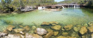
A quick stop was required, firstly at Fruit Bat Falls to wash away excess bulldust, then at Bramwell station to view the “Rego tree”. then on to Moreton station for the night.
A “short cut” from the Old Telegraph Track south of Moreton took us across Batavia Downs station to York where we joined the Peninsula Developmental road leading to Weipa. With the exception of a few heavily corrugated sections this road soon improved and before we knew it we hit bitumen driving into Weipa.
Just north of Weipa lies the Pennyfather River, supposedly a top fishing spot, but also a beautifully peaceful beach camp.
Access is via a Rio Tinto mining lease and the only traffic lights we have seen for a while were those for mine vehicles passing. The boom-gate was broken so we watched quite a few monster trucks pass by, with loads of dusty bauxite piled high in the hold. Even the water trucks managed to dwarf our cars waiting patiently for the gates to rise. They follow behind spraying hundreds of litres of water on the road to reduce dust levels. In the end Simon jumped out of his car and physically lifted the boom-gate so all could pass.
Being on Aboriginal land a permit is required but once there a very long beach offers many camping options, from basic amenities for a small fee, managed by a ranger to free camping along the beach, south of the local beach shacks. We chose the latter, searching for a site that another family had told us had the makings of a funpark made from washed up debris from the beach. After ten minutes driving along the soft sand it was time to stop and we found a great shaded spot with a tyre swing. The Gulf waters lapped gently on the beach and the glassy water was a welcome change from the wind blown east coast. Thirty minutes later an onshore wind blew up and brought a veritable swell with it, shattering the initial idyllic appeal of this west coast.
It did improve the next day and we had fun trying unsuccessfully to catch massive trevally that were cruising up and down the shoreline. The fishing gods were not kind to us and once again sausages hit barbeque instead of fresh fish.
The kids built hammocks from fishing nets, strung between trees, and spent hours on the tyre swing.
Whilst we didn’t find a plaque, and there must be one there somewhere, the Pennfather River has historical significance as being the first place that a European landed in Australia. Willian Janszoon, a Dutch navigator, sailing in the Duyfken landed here in 1606, long before James Cook.
Today this area is totally alcohol-free and it is not permitted to even carry alcohol into this area, however, with no-one policing it, discarded bottles and cans litter the sand and bush where some people found it easier to discard rather than take the rubbish with them, thereby spoiling it for future visitors.
From Pennyfather we headed north for a couple of days to Mapoon where the Dulcie River meets the Gulf. The camp on the western ocean side offered more protection from the wind and on local advice Jackie Creek some 12km south along the beach offered good fishing opportunities
The kids together with Simon and Hilary’s girls scoured the shoreline for materials and commenced building a “humpy” city. Humpys are the temporary shelters that aborigines used, conical huts made from logs, with leaves or fur to cover the roof. The kids made scaled down versions from the long mangrove seeds that can be found everywhere, washed up with each tide.
Oscar and I slipped away for a quiet fish, driving down to Jackie Creek where we saw locals using spears to catch mud crabs amongst the reef. We had no success but witnessed plenty of “bait balls” of fish being doggedly pursued by larger fish around them and by a large flock of hungry terns diving wave after wave into the throng for a meal. The next day we returned at the right point of the tide and for a busy half hour caught mangrove jack for dinner, whilst keeping an eye out for a large crocodile we had seen when we arrived.
The wild horses called brumbies proliferate around Mapoon and Pennyfather too and it isn’t unusual, driving along the beach, to spot small groups or see their footprints coming to and from the beach and swamplands behind. We only saw the one crocodile and had a couple of shallow swims, then a local advised that they live in the swamplands behind the beach at this time of year, waiting for the big wet to arrive when they become more mobile and visible.
Shorebirds were present in abundance but with my ailing Canon EOS camera struggling to focus correctly, I couldn’t capture images


Recent Comments